Finally set up my base and hopefully figured out how to align it with the official German reference System aka ETRS89/DREF91 (R2016) aka EPSG:10284
‘RTKbase on Futro S900 x86 thin client - #12 by wjr’
Expect ~5 cm alignment to official maps.
Let’s check it
- Survey stick as above
- good old Samsung S7
- GNSSmaster from Google PlayStore
- my own internet ntrip caster, forwarding my own base stations rtcm
- ‘https://atlas.bayern.de/’ in DuckDuckGo web browser
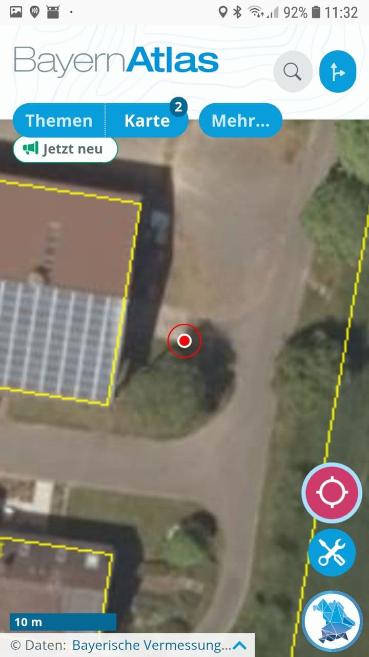
Open “Themen / Vermessung und Luftbild /Liegenschaftskataster” and activate “Luftbild mit Parzellarkarte”.
This opens an arial 20cm-pixel DOP whith buildings, estates boundaries from the official cadastral map.
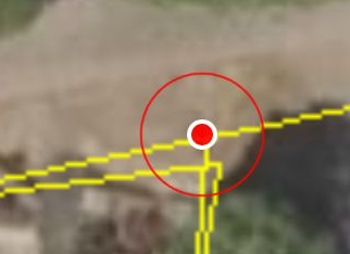
RTK fix location from the mock provider can be activated in the web app.
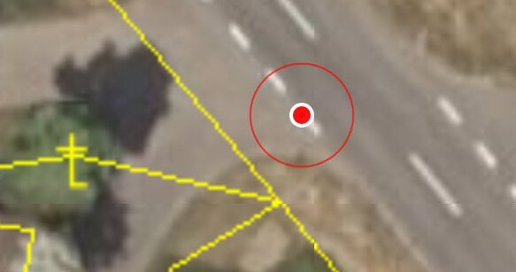
Edged structures on the surface can be visually extrapolated beyond the 20 cm pixel limit.
Within this precision, it looks like my setup matches better than 10 cm to the DOP.
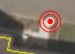
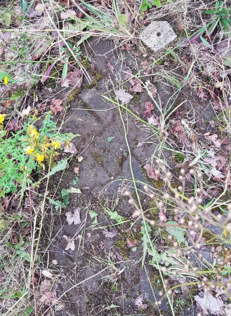
However, when I tried to find some covered markstones, it was not that perfect.
I first started searching nearly half a meter off the postion where I found it in the end.
Well, that’s 2 pixel…
Can we be sure that the markstones were surveyed that precise decades ago?
Can we rely on the precision of the DOP and the alignment of the cadastre?
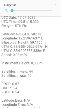
GNSS master shows the coordinates, so I can try to compare on QGIS, using more precise tools and data.