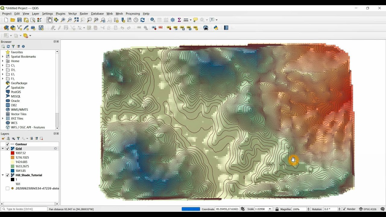
What software would you guys use to do an altitude survey using an RTK F9P? I’d like to plan some drainage around the yard and then eventually put tile in the field.
Qgis works well. You can add contours and stuff. I have been logging in ucenter sampling at 3 seconds instead of 10hz, with lat, long, and hae then importing them into qgis. The first part of the video is creating a csv file, which you wont need to do if you have gps logged data
I do have a f9p with bt, is there an Android app that can log?
That’s superb!
I think it’s exactly the solution I wanted for something, will test it later ![]()
The Ntrip client from Lance Lefebure. Need to purchase premium features. Multiple free apps for your AOG computer.
EDIT: saving NMEA data should actually be part of the free fersion, as well as saving NTRIP data. Not sure why my phone does not show that option.
EDIT2: saving NMEA data is only available when an external GNSS modem is connected. Makes sense. Anyway part of the free features.
Any idea if the premium version also works to apply NTRIP RTK correction to the internal Android GPS? On the free version, it sounds like it only works on specific Android dev devices.
I’m not aware of any Android GPS that would be RTK capable. Even F9P is half the price of a decent phone. Google Play shows the premium version features.
For android, most of the phones, you can use a mock GPS. You simply feed your corrected GPS signal into it. The phone will replace the computer not the good GPS. There is a short list of RTK compatible phones. Mine is not on the list, odds are yours is not on the list either.
Not on the topic but if a phone accepts an external GPS receiver, why would it not accept an RTK accuracy external receiver? Is it about the higher accuracy NMEA (configurable on an F9p)?
My reason for asking about correcting the internal Android GPS was to get better accuracy for flagging/pinning POI with apps.
For some reason, I just can’t find any list of premium features on the app store for Lefebure NTRIP Client.
Yes, if your GPS can get the corrections, the phone will accept the corrected GPS.
I’ve got a “Survey Stick” Android app that I wrote…it morphed into a tile drainage app. I’ve got a farmer who tiles using it to map tile depth and figure out tile grade. Import a field image from Google Earth. Geo-reference 2 spots. Draws path through the field as you travel. Graph of surface elevation change vs. distance traveled with 2nd line for tile line with start and end depths adjustable. Using Sparkfun’s survey grade antenna with F9P and NTRIP. I need to add some images…probably won’t get to it for a bit as I’m working on a AOG mod. But see the Survey Stick under the sales tab at OutFarming.com. Demo: OutFarming.Com by Out Farming. Contact me for more info. Jim
