Try messages
1005(10),1007,1033(10),1074,1084,1094,1124,1230
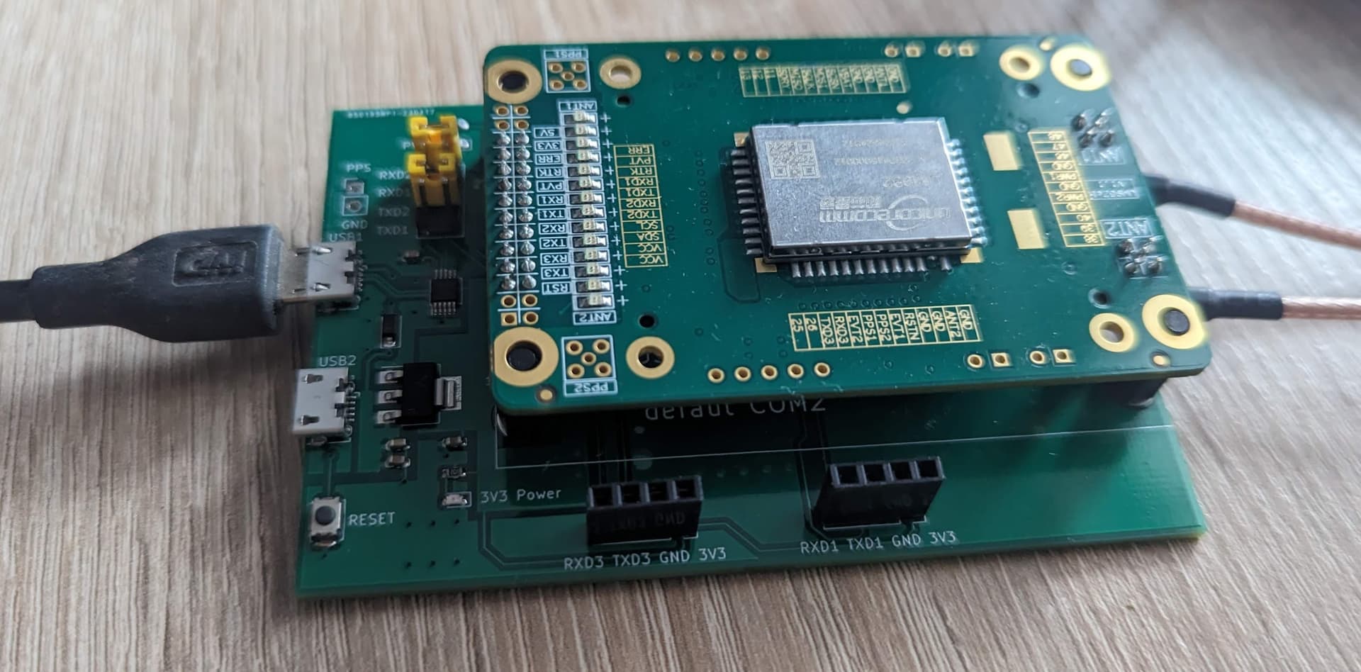
Nothing arrives in AIO. I have my UM982 on the ByNav slot on the AIO board. Do I have to adapt the sketch on the Teensy? If so, does anyone have a finished HEX file?
How you configured um982?
Anyone has experience with mentioned Quectel LC29H and AOG? rtklibexplorer made a nice comparison between this and F9P and it looks like they are very similar (regarding the RTK fix), except the Quectel is cheaper (like, a lot).
So I would say, if you are satisfied with F9P-like RTK power, go for Quectel LC29H (EA) - same power, but much cheaper. If you are willing to pay as much as for F9P, go for UM982, which costs roughly the same, but is much better.
What config file is used to make all the settings correct? Or do you have to go through and make them each one by one?
Have in early testing now:
- Unicore UM982
- Quectel LC29HDAMD
- UM626
Last two I ordered before I even became aware of the current state of AgOpenGPS.
For my Tractor purposes, I came tot he conclusion that UM982 is the preferred way to go for me.
Details on the UM982 I discuss already “over there” in the “F9P-killer” thread.
But may be I attach one of the "even cheeper"s to my mobile as survey stick, running some GPS logger or QField.
And/or one with a AOG tablet only for light bar steering at “simple” applications
In current test stage, I have antenas at the window sill, and one above roof top.
No own base station yet.
I have an account for Bavarian LFPS ntrip caster, which produces an artificial emulated signal from multiple real station, supposedly matching the precise location. At least that’s what they promise.
I also tried other public ntrip casters with mostly discouraging results.
Software platform for most tests is a bare debian1 linux, with stty, cat and echo as the main tools for serial communication.
Ntrip client is BKG BNS Version 2.12.18.
Dual-frequency Multi-system RTK Tracking Positioning GNSS Module UM626N GPS L1 L5 Base Station 10Hz Raw Output Support RTCM NMEA
This kit comes with 3011A Helix antenna (labelled as L1/L5).
I’ve put this on a 16 cm steel ground plate above roof top.
Since the UM626N is the only board with embedded USB, it was the first candidate to test.
I could not get any RTK with my LFPS caster.
I tried another caster called HS_Coburg from rtk2go, which delivered RTK float (fix level 5) on rare occasions. However, all rtk2go casters either deny service or drop out at short times. And it’s ~ 70 km afar, so no much practical use anyway.
Nevertheless, even normal level 1 fixes with 20 … 30 satellites and HDOP ~ 50 cm seems promising.
Sadly I can’t find any serious documentation for the UM626
The main reason I bought it was the onboard USB UART.
However, such a part is easyliy attached to a LC29H, which is not more expensive but comes with extensive documentation.
Just for the curious, a complete output sequence for one of the rare RTK floats:
$GNGGA,191001.000,4959.0585896,N,01215.6001556,E,5,19,0.747,558.811,M,46.641,M,1,0000*7A
$GNGLL,4959.0585896,N,01215.6001556,E,191001.000,A,D*42
$GNGSA,A,3,30,7,20,9,5,11,,,,,,,1.370,0.747,1.148,1*06
$GNGSA,A,3,,,,,,,,,,,,,1.370,0.747,1.148,5*38
$GNGSA,A,3,23,20,37,9,32,19,5,,,,,,1.370,0.747,1.148,4*3B
$GNGSA,A,3,8,25,3,15,13,16,,,,,,,1.370,0.747,1.148,3*33
$GNGST,191001.000,,,,,0.244,0.151,0.324*73
$GPGSV,3,1,9,7,68,76,47,11,23,230,43,9,33,91,42,20,61,269,47,1*5F
$GPGSV,3,2,9,30,68,200,49,21,,,47,26,,,15,5,37,306,45,1*6B
$GPGSV,3,3,9,13,21,272,40,1*6F
$GQGSV,1,1,0,1*55
$GPGSV,1,1,4,11,23,230,48,9,33,91,50,30,68,200,52,21,,,53,8*6C
$GQGSV,1,1,0,8*5C
$GBGSV,5,1,19,38,,,13,33,,,12,40,,,14,34,,,17,1*70
$GBGSV,5,2,19,57,,,14,43,,,16,45,,,16,9,24,51,40,1*47
$GBGSV,5,3,19,17,,,16,56,,,40,18,,,15,44,,,13,1*71
$GBGSV,5,4,19,42,,,17,32,42,118,47,20,77,302,53,23,40,60,47,1*76
$GBGSV,5,5,19,37,57,145,50,19,26,299,48,5,18,126,40,1*72
$GBGSV,2,1,5,32,42,118,50,20,77,302,51,23,40,60,50,37,57,145,51,5*7D
$GBGSV,2,2,5,19,26,299,48,5*75
$GAGSV,2,1,7,8,45,277,47,25,32,114,43,3,76,58,49,5,25,85,37,7*73
$GAGSV,2,2,7,15,26,223,42,13,35,285,45,16,34,84,44,7*47
$GAGSV,2,1,7,8,45,277,50,25,32,114,47,3,76,58,50,5,25,85,46,1*79
$GAGSV,2,2,7,15,26,223,48,13,35,285,50,16,34,84,48,1*43
$GNRMC,191001.000,A,4959.0585896,N,01215.6001556,E,0.001,0.000,120625,,,F,S*0B
The LC29HDAMD came with an antenna at a shocking price of ~ 36 €
OK, it’s the 1 Hz Version only.
And the antenna is broken … zero to one satellites in view…
And I need an extra USB UART.
An old prolific 2303 from my junk box supplies RXD, TXD and 5V - fine.
(btw:would not buy an 2303 any more, since notorius driver incompatibility issues both on WIN and Linux)
I tried loads of fiddling with another antenna
at the window sill.
Promising Level 1 fix data, but no RTK.
But Quectel supply loads of documentation, among them
/quectel_gnss_rtk_application_note_v1-0.pdf
including a chapter
5.2. Why the GNSS Module Fails to Enter RTK Solution Mode
- frequency bands of correction data have to match module
- base station should not be more afar than 30 km
- decent SNR
- open sky view
So I attached the LC29H to the antenna from previous test.
Ran BKG ntrip client (BNC) Version 2.12.18 with FPS_BY_RTCM3_4G against it - and voila - within seconds, my first RTK fix since my experiments with rtklib nearly a decade ago:
$GNGGA,203851.000,4959.058256,N,01215.597917,E,4,36,0.37,554.339,M,47.220,M,1.0,1225*50
$GNRMC,203851.000,A,4959.058256,N,01215.597917,E,0.005,249.95,180625,,,R,V*24
$GNGLL,4959.058256,N,01215.597917,E,203851.000,A,D*41
$GNVTG,249.95,T,,M,0.005,N,0.009,K,D*29
$GNGSA,A,3,05,07,08,13,14,15,18,20,22,23,30,,0.66,0.37,0.54,1*04
$GNGSA,A,3,65,75,76,77,83,,,,,,,,0.66,0.37,0.54,2*0C
$GNGSA,A,3,02,07,08,10,12,19,27,29,30,33,,,0.66,0.37,0.54,3*0C
$GNGSA,A,3,05,07,09,10,19,21,22,36,40,45,,,0.66,0.37,0.54,4*00
$GNGSA,A,3,,,,,,,,,,,,,0.66,0.37,0.54,5*00
$GPGSV,3,1,12,05,50,233,50,07,23,068,41,08,11,038,37,13,69,301,49,1*6A
$GPGSV,3,2,12,14,56,135,46,15,33,299,48,18,10,308,34,20,28,202,45,1*62
$GPGSV,3,3,12,22,45,158,48,23,05,330,37,30,56,068,49,36,29,155,45,1*6B
$GPGSV,2,1,05,08,11,038,47,14,56,135,51,18,10,308,37,23,05,330,42,8*6B
$GPGSV,2,2,05,30,56,068,52,8*51
$GLGSV,2,1,06,65,38,138,44,75,35,039,47,76,78,179,50,77,29,210,43,1*79
$GLGSV,2,2,06,82,01,290,33,83,10,336,42,1*74
$GAGSV,3,1,10,02,19,040,36,07,62,108,46,08,11,111,34,10,08,341,37,7*76
$GAGSV,3,2,10,12,14,319,35,19,12,293,23,27,36,169,43,29,58,295,46,7*79
$GAGSV,3,3,10,30,54,093,46,33,14,266,30,7*7C
$GAGSV,3,1,10,02,19,040,43,07,62,108,51,08,11,111,42,10,08,341,45,1*70
$GAGSV,3,2,10,12,14,319,40,19,12,293,29,27,36,169,50,29,58,295,52,1*70
$GAGSV,3,3,10,30,54,093,50,33,14,266,36,1*7B
$GBGSV,3,1,11,05,17,126,38,07,21,071,37,09,11,066,38,10,22,084,38,1*7B
$GBGSV,3,2,11,19,40,153,47,21,25,311,47,22,73,262,51,36,72,189,50,1*78
$GBGSV,3,3,11,40,21,064,40,45,24,220,45,60,03,109,30,1*4F
$GBGSV,2,1,06,19,40,153,48,21,25,311,50,22,73,262,51,36,72,189,51,5*70
$GBGSV,2,2,06,40,21,064,46,45,24,220,48,5*78
$GQGSV,1,1,00,1*65
$GQGSV,1,1,00,8*6C
An awful lot of 36 satellites in the solution.
Not really stable - 20 % of the time it drops to RTK float:
~/tmp/ntrips$ grep GNGGA GGA.log | grep  ',E,5' | wc -l
1168
~/tmp/ntrips$ grep GNGGA GGA.log | grep  ',E,4' | wc -l
4486
And a HDOP of 0.37 = 37 cm by far misses the expectation and promise of 1 cm precision.
Maybe it’s the fault of the RTK data?
I’m planning an UM980 base station and will give it a test, then, again.
Sorry for this bull$…tt
HDOP obviously is not in meter.
Thanks to Vera from Hitech store for clarification.
Replaced the PL2303 by CP210x so that WIN11 recognizes it.
UPrecise shows most positions of the last hour within a cycle of 1 cm radius.
More than enough for field survey.
edit: Already on my WIN tablet, give it a try in AgOpen GPS as well.
(have to admit little to no experience yet)
Configuration is straightforward, and it displays “RTK fix AGE 1.0”
Coordinates look correct, no visible jitter.
And it works with Andoid GNSS master as well.
Tested “mock location” with QField and my venerable mendhak GPS logger.
No doubt, the LC29H is worth the (tiny) money and the steps on the learning curve.
Ordrered another LC29HEA (the 10 Hz variant) for my experiments on my small tractor.
Hello,
Has anyone gotten the LC29HEAMD module to work?
What parameters need to be set for this?
I would appreciate any feedback.