I started to look at the KML files that we generate via AgOpenGPS.
I prepared a pull request already so during save we can add extra information for the KML files:
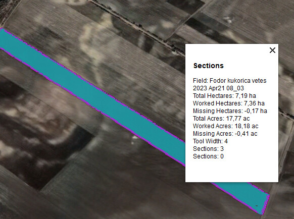
So far this is the info I can harvest, but the sections / implement details only available during save.
I also created a small java program to merge all the Fields.kml that we have under Documents folder.
So all the operations would be visible by opening a single file.
Here’s the “program” itself if anyone wants to give it a try.
v1 AOG_KMLMerger_0.1.zip (2.7 MB)
v2 added bat with default Documents folder location for hungarian users: AOG_KMLMerger_0.2.zip (2.7 MB)
I used Talend Open Studio for it but basically I take the existing KML-s and except the first 3 / last 2 lines I put them in a structure of:
<Folder>
    <name>AOG Field FolderName</name>
          <!--- Original file content -->
</Folder>
Well the program is ready and anyone can test it, we’re missing the worked area calculation but that seems to be done by AOG so we’d just need to add that as an extra description to the sections.
Maybe we could find a way to maintain a central “AllFields.kml” from AOG itself which would hold all fields + operation kind.
This was interesting.
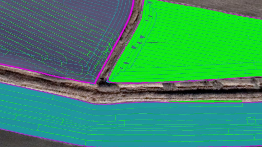
I’m working on the KML files to make some sort of job manager.
The way AOG is at the moment, it would be a dirty hack, but it’s a start. In my case almost only me using it anyway so…
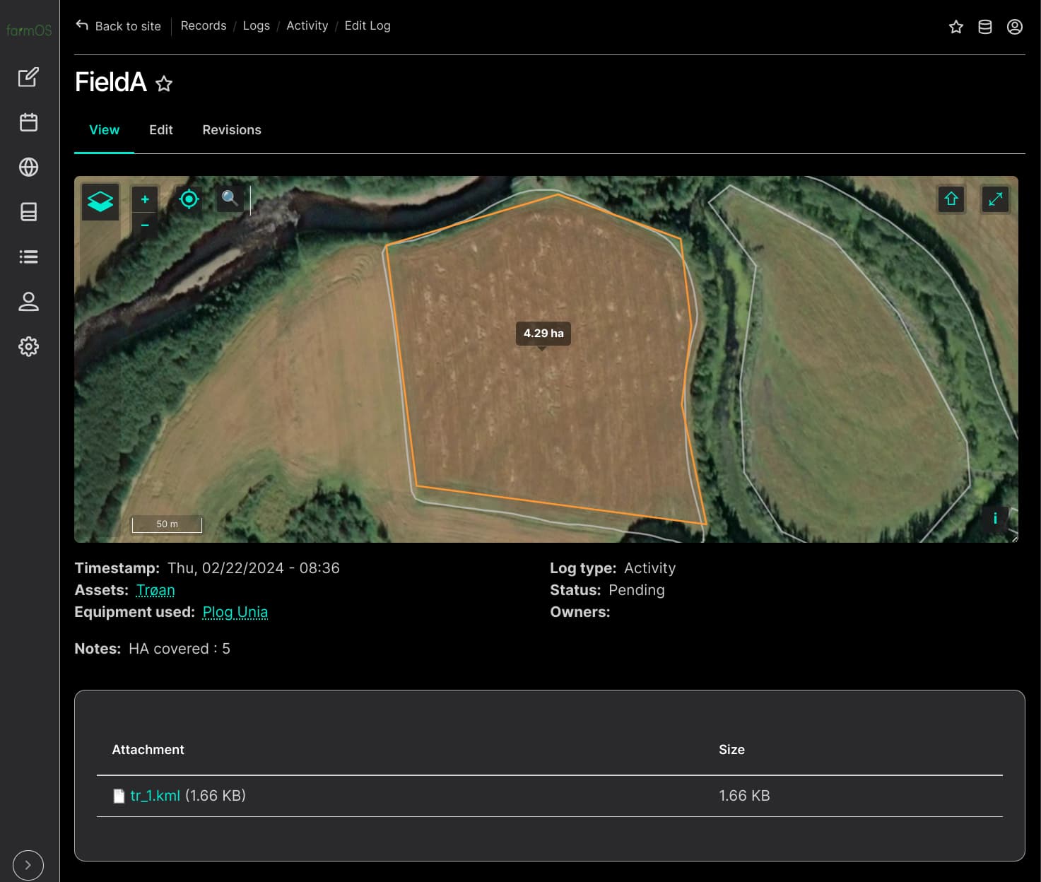
With the new AOG its easy to add equipment name to the fieldname when creating a new field based on another. Plan is to parse folder name of the most recent folder, and the add this as work log in farmOS.
And then add the KML-file.
I have not understood how the field files are related to each other yet…
There are KML and text files.