Hi All. I am brand new to AgOpenGPS. I think its a wonderful idea. I have downloaded and installed the latest version (6.0.9) however I am really struggling with getting things going. I am simply trying to familiarize myself with the software in simulater mode. I have managed to create a field but for the life of me cannot figure out how to create AB lines. etc. and actually “drive the field”. None of the icons have tooltips or indicate what they do and the help simply points to this site. Is there an actual fairly comprehensive tutorial/begiiners guide that walks through the software and how to create fields/maps/AB Lines, etc.? (beyond the beginners guide thread that basically says download and install the software, create a a field and create your machine).
This
And if you click the ? at the top of most of the windows, then some random button, it should pop up a help window. Definitely not all the buttons have the help window, but they can be really helpful.
I feel your pain. I have been using it off and on for 5 years, and every time I use it, I wish the buttons had written labels or a pop up flag with a 1 or 2 line description.
The real answer though, like with a lot of things, is just practice practice practice.
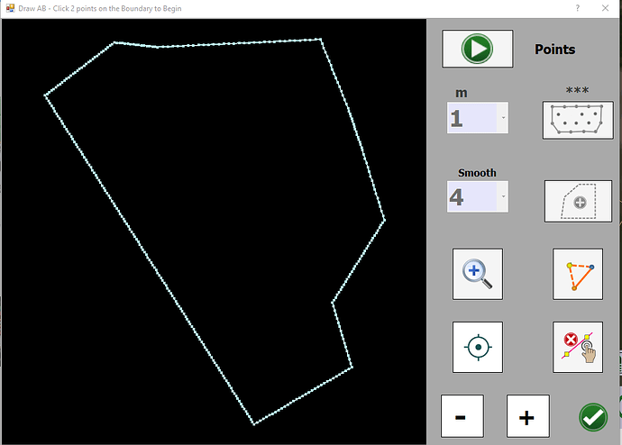
So I have used the ? button and it described about 1/2 the buttons. But again I simply cannot figure out how to get simple AB lines on the field. I was able to find this Boundary Tool window which says to draw AB lines on the boundary…but then does nothing at all. Please help anyone know how to get AB lines?
Kazam_screencast_00000.mp4.zip (8.4 MB)
Download and extract. I wasn’t sure how to send screen recordings on here.
The first method shows how to make off a and b. Second off boundary.
Let me know if that doesn’t work.
I feel your pain, I love AOG and have been using it for 4ish years, I have started the process of upgrading to the all in one board. It is always a bit of a commitment to learn and find all the information. There is a really great community that is willing to help but I don’t want to be the guy that asked everything all the time. Also the more one knows about the system the better AOG will work for you as a user. I always looked at it as a bit of a hobby that is really useful for real farming.
There have been real attempts to make AOG more user friendly, the problem is the system, hardware and software move fast. And some attemps at improvements just make it more complicated and aren’t necessary for the average user. So it is important to just start with the basics and keep improving on your system.
Personally I love YouTube videos that explaine, but that takes time, I have thought about making some videos myself but usually I’m just happy if I get enough time to get my own system working.
Good luck, use the search icon in the discourse, and then just ask
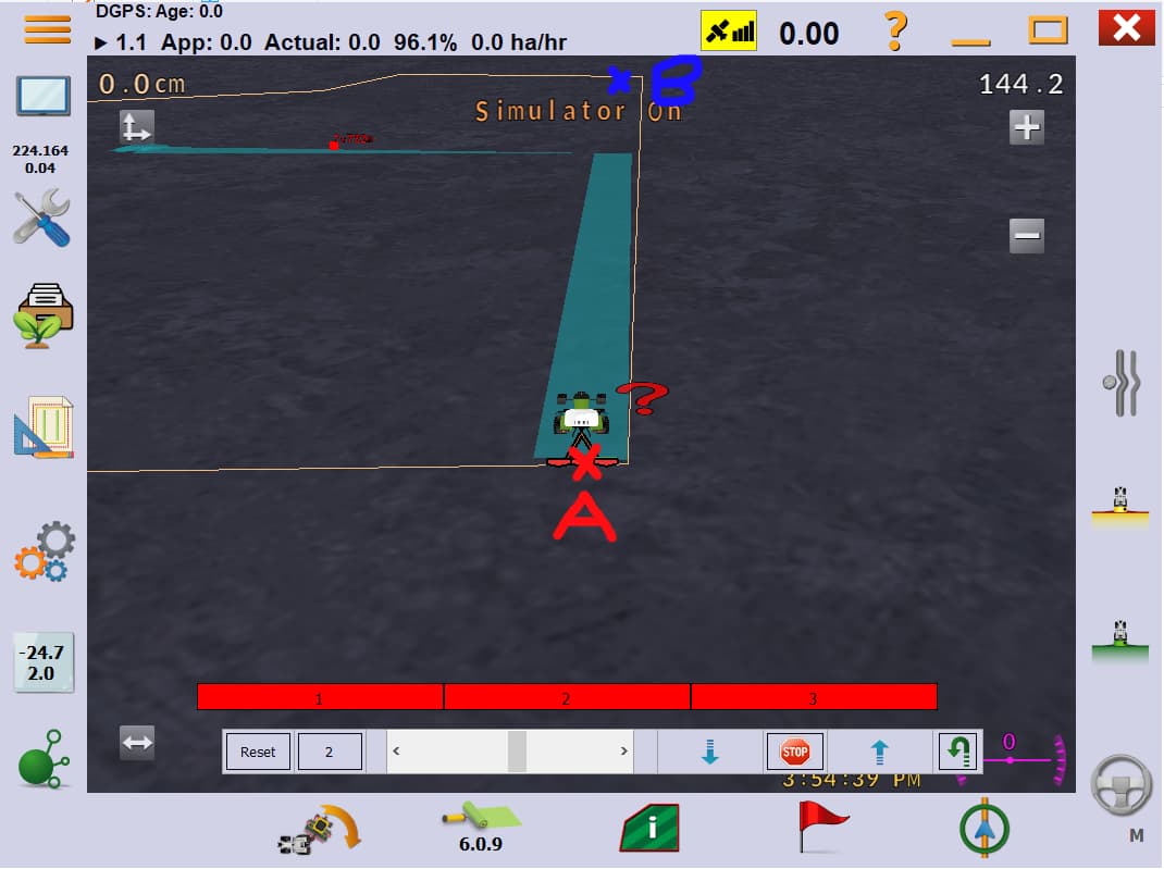
I downloaded and extrracted. Thank you! Its starting to become clearer but this is a pretty steep learning curve. Basically in a system I should be able to enter tractor/implement parameters. Drive to a spot in my field where the right edge of the implment is setup on the boundary. Drop Waypoint A in red attached…then drive with the implment up…i.e not planting/spraying/etc…drive to the to the other end of the field…with the implement again lined up on the right edge at the boundary (or wherever I want my waypoint line) then drop waypoint B in blue. The system should then draw the AB line and replicate the lines across the entire field. This is how any farm/tractor GPS system that I have used works. Very simple. Can this be done with AGOpenGPS?
Well in the video, I showed how to set an AB line using points A and B. But I never use it. I just make them off the boundary. Then they always line up.
Tractor settings are in the triple gear ![]() icon in the left column.
icon in the left column.
Hello, Chris
which country are you from?
From Eastern Canada
Is not nearby! I thought according to your name, Netherlands or Belgium!
Ah yes…my father was born in Wanroij, North Branbant in the south of Netherlands!

