I’ve seen a post on planting an image using section control to create a corn maze. But I’d like to cut the maze. The field is cross planted - seed is in the ground now.
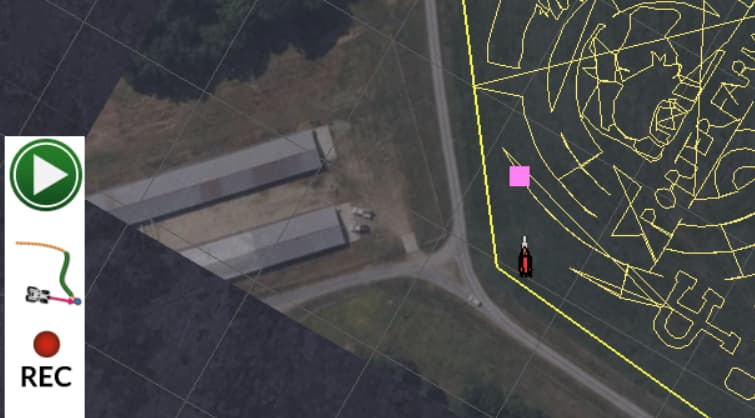
I have shape (.shp, .shx) files and am trying to convert that to a recorded path that AOG can lay down on the screen for me. I mostly have that working using a Python script I put together. Here’s what it looks like in AOG.
As you can see there are lines that are cluttering up the path – these I’d like to get rid of if possible but can find nothing in the shape files that could be used to tell me they aren’t needed.
I have only read what the recorded path file format but have never seen one. I guess I could go create one in the field but the machines are all out today doing other work.
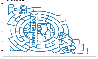
The shape file looks like this. (rendered in matplotlib with geopandas data frame.
Any one have more details on the recorded path file format or other input about cleaning up these stray lines?
I don’t really intend to autosteer this path – I’d be very happy to just manually steer, cut, and paint the display with the worked areas.
Thanks in advance. We’re about to add AOG autosteer to our third machine:
JD6420
JD6115D
JD4640 (up next!)
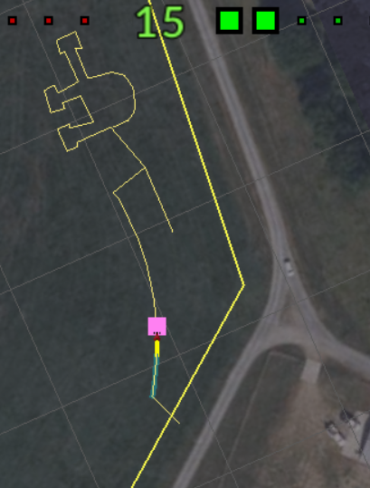
Well, recorded path is designed to have a row of points, which are connected, so you would have one line beginning, and one line ending. It cannot have 10 or 30 or 50 ends.
that didn’t cross my mind @Davidwedel - but I believe you are correct. The shape file contained many paths and those were being cross connected when I loaded the recorded path into AOG. It dawned on me shortly after I posted this.
So I digest the shape file and create multiple recorded paths each of which is a part of the maze. Those load up nicely and can be autosteer-ed in the simulator. Here’s the first path…
I’m using a 5ft zero turn to do the cutting and now trying to figure out how to describe that “tractor” to AOG. I won’t be using autosteer in the field just using AOG to get me in the right place where I can cut and paint!
Thanks for the clarification – I got lucky, but when I saw your post I realized why this had occurred.
It is one at a time which, I think, will make it easier to work. Waiting for the shape files to come in for this year’s maze. We let someone else do the creative work!
@holobox did you get all this worked out? I am looking a system to use to cut our cornmaze as the previous cutter is no longer available and curious if you would share your thoughts, process, and set up? Thank you.