Field boundary not rectangular

Hello,
I started using AGOPENGPS using a win10 Notebook, connected an F9P via USB (connection is fine) and NTRIP. Signal is fine, no failure is shown.
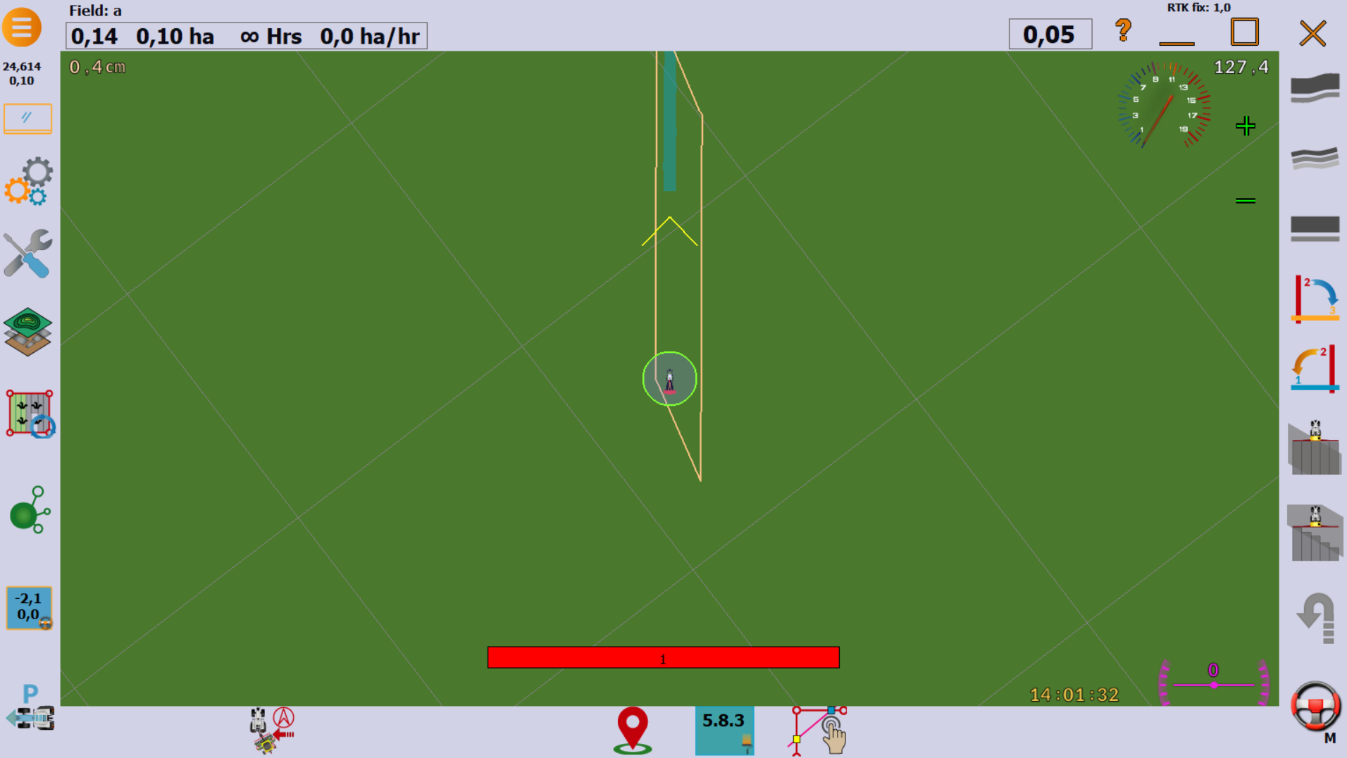
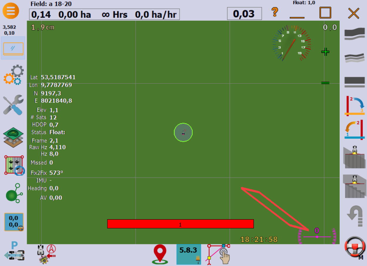
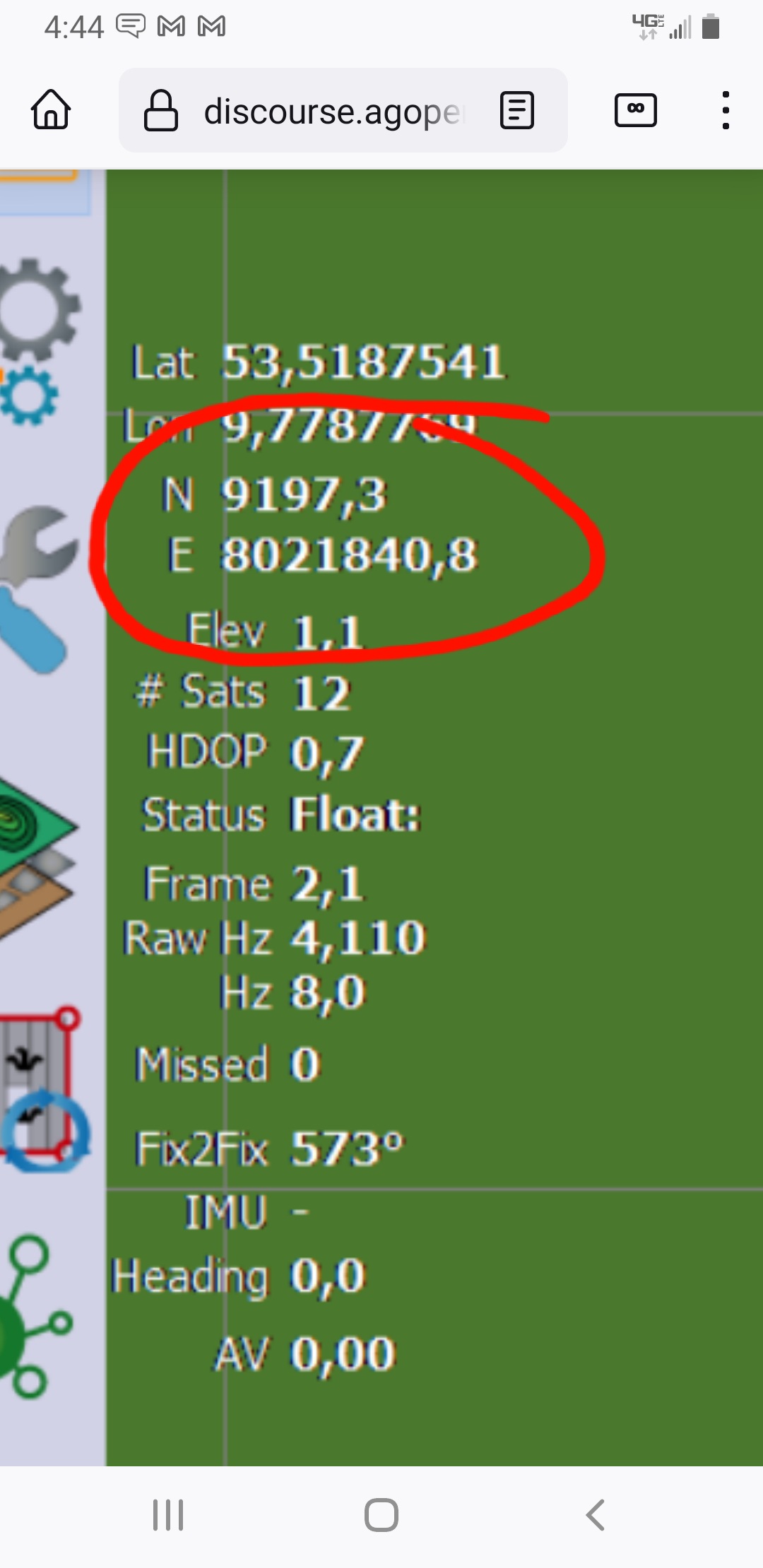
I recorded the boundary of a field. The field is rectangular, but the recorded boundary of the field looks not rectangular. See picture below.
Does anyone have an idea why this happens?

Regards from Hamburg,
Henning

Did you create the field in simulator mode?

If you did, delete the field, and create a new field while you’re at the field.

Can you press the speed top left so we can see the easting/northing distance.

Most of time the cause would be a field created to far away.

No, it was in the field.

At the moment, i am near the field at home. Do you want me go to all edges of the field and post the positions?

Two general questions:
The 1,9cm in the top left edge, is this the gps accuracy?
And what does the “Float: 1,0” in the top right edge mean?

The simulator was not set when the field was created.

Delete the field, and create new field when you are in the field getting ready to record a boundary.

And turn off the simulator first.

1 Like

The standard position is at Brian’s place in Canada. To avoid this problem set simulator position to your place, (just within some kilometres is OK)
Then this problem does not occur even if field is created when SIM is on.

1 Like

Problem solved, thanks for your help!

how??

As Davidwedel and Larsvest described the problem occurs when you start to create the field in SIM Mode and then go to the field.
So just enter your coords in SIM (maybe thats not even neccesary) and start creating the field when you are near the field. Then it works as it should.

3 Likes