Hello, is it posible to get cordinages in rover mode, and agopen gps?
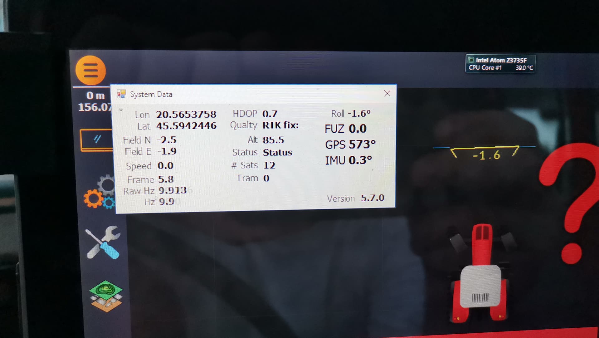
I can se longitude and latitude in system data window but…
Where is altitude
Is it this where is pointer on picture?
If its not, can i get fix on agopengls, disconecct and connect ucenter and se there?
Module is simplertk2b so i cant conect it to caster.
i can strip down from one tractor c099f9p and give it fix over bluetooth but that is too much work .
im taking coordinates for base station and fix from another base station witch is measured.
Remember 7 decimals for Lat/Lon is of the same order as one for the altitude in metres. Why would you want the altitude at multiple orders of magnitude higher resolution than the actual accuracy is?
If the base station position estimate was accurate to a few cm (vertically), I would use at least 2 decimals but I cannot see how this is related to the figure AOG is displaying? Are you controlling something manually based on the AOG altitude reading? Or are you using some accurate RTK source and trying to figure out your private base position based on AOG readings? I’d use u-center, log data and average a reasonable number of measurements to obtain the base position estimate.