I watched a few onboarding videos and I noticed that the app is kinda like John Deere gps monitor where the “earth” is just a grey screen where you create lines and such. Is there a way to imbed an api from Google Earth or some other source so that it would show the satellite view like it does on Google Maps?
Seems like that would make it much more handy if we were able to look at the field, draw a geofence of where we want it to drive, then AOG would auto find lines in those boundaries then all we would have to do is correct those lines some, since satellite view doesn’t always seem to be accurate.
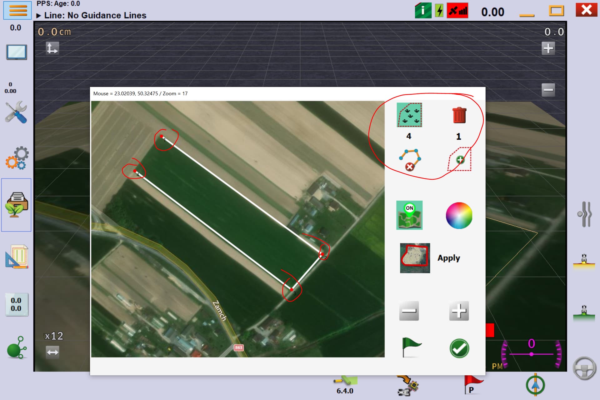
With Deere you can download satellite imagery background and not have a grey screen.
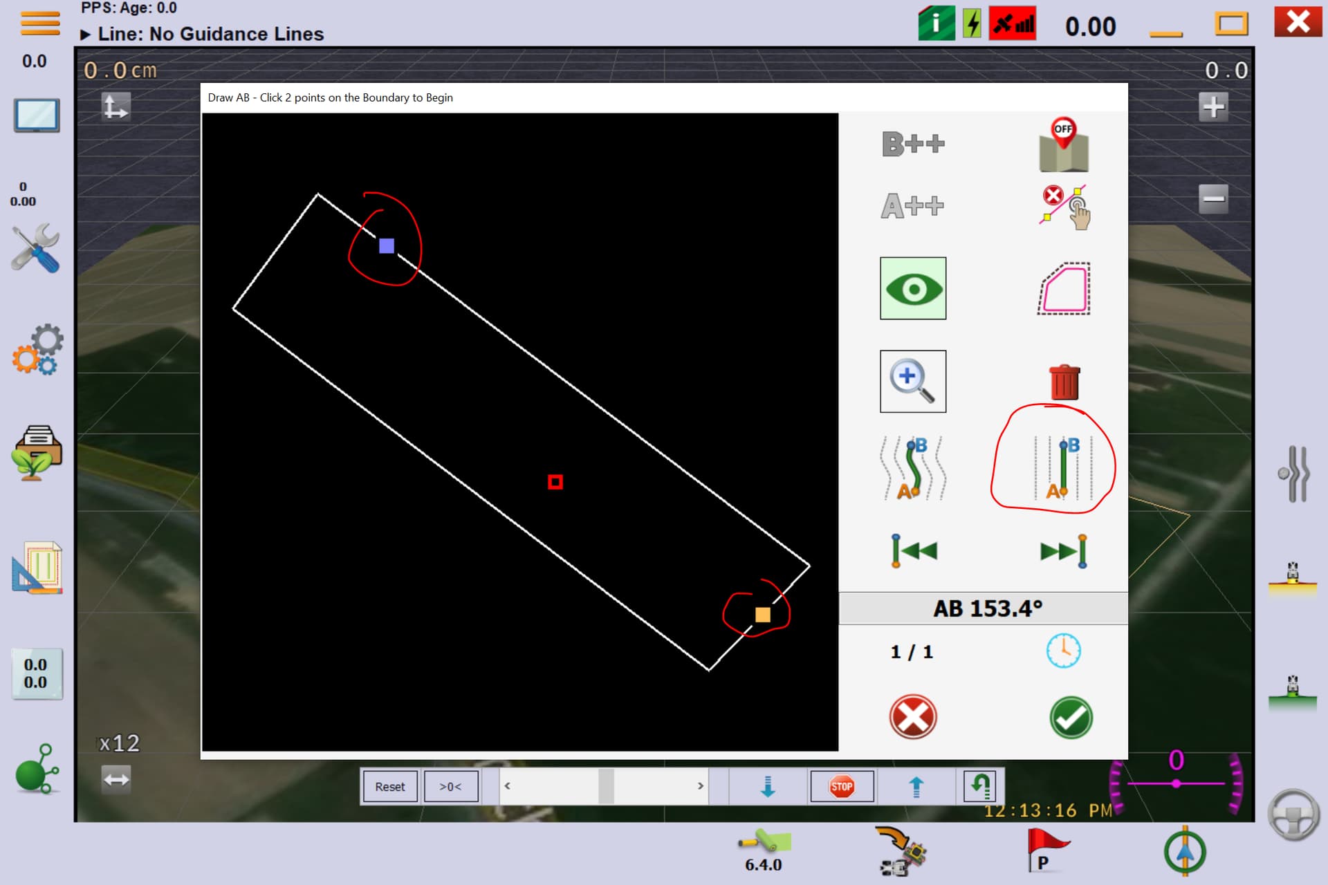
This feature has existed in AOG for years, but it uses Bing maps because of the way things are geo-referenced. Open the Boundary tool, click the B Bing logo, click the picture, press apply.
We don’t call it a geofence, we call it a boundary. You can draw your boundary on the satellite image in the same menu. We don’t call them lines, we call them tracks. Once you have created the boundary, you can create tracks from the boundary. You have to manually click some points to create the tracks.