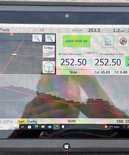
hi im new to open grade 3d and cant figure out how to make it work does anyone have a good tutorial Thanks Dylan
There are no tutorials I’m afraid
There are some info in the read me here:
You must import a text file in .agd format (or modify source code to read others formats). Exemple here:
Latitude (deg), Longitude (deg), Elevation Existing(m), Elevation Proposed(m), CutFill(m), Code, Comments
46.50541598, -72.34992609, 30.324,,,0MB,
46.50509963, -72.35053513, 30.323, , ,2SUBZONE3,
46.50508650, -72.35051125, 30.324, , ,2SUBZONE2,
46.50353237, -72.35174967, 29.480, , ,2SUBZONE1,
46.50541365, -72.34995212, 30.266, , ,2PER,
46.50541081, -72.34987877, 30.296, 30.275, -0.021, 3GRD,
So the program I downloaded from your git functions as it should. I think. The one from AGO didn’t survey and was missing parts of that feature on my install. I also found the INO for the height on the implement. Do I add it to the basic steering INO? Or is it not possible to steer with one valve and control height with another?
For some reason I can’t find the Ntrip settings on this version.
Or does it only work with XBEE RTK?
Should be in the blue “config” button. Be sure to look in the releases to have the last one
Opengrade doesn’t steer. Or I must say I never checked if it can steer
OpenGrade and Opengrade3D are 2 different programs performing different tasks.
OpenGrade for standalone survey/grading
OpenGrade3D for levelling using a prescription map built by a third party software
