You know what they say, the only difference between a farmer and a welder, is the welder doesnt think he can farm, so dont judge my welds too much!
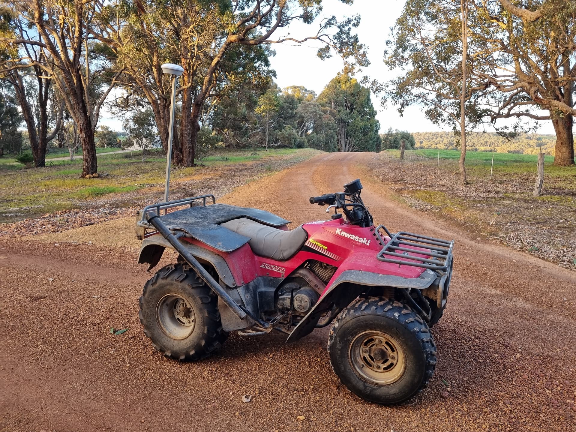
Still relatively new to using AoG, and have been struggling with making boundaries, a combination of taking time to drive around paddocks with the sprayer, navigating around trees and such with boom wings out. So decided to copy all the BTOs (big time operators) and set myself up a survey rig!
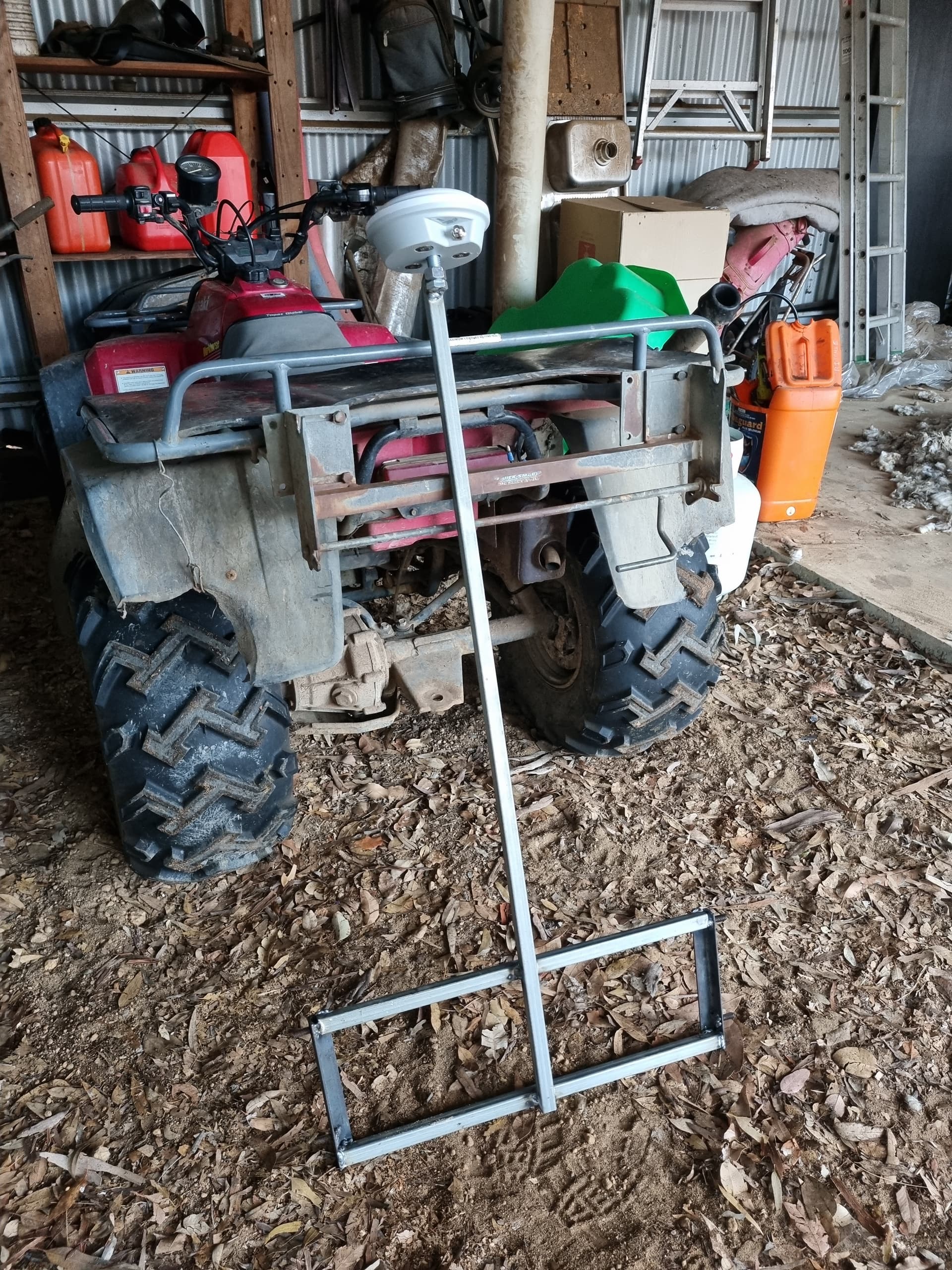
The fellow Australian/NZ farmers might recognise the C-Dax quick attach rack fitted to my trusty Kawasaki steed. I made a frame to fit the quick attach rack, with a 1100mm mast and whatever size imperial bolt fits my ali-express AG25 antenna.
The idea is that sit my spare PCB on the rear deck, laptop on the front and drive around quickly and accurately map my paddocks interior and exterior boundaries.
Thought this might be of some interest to people looking to make a budget survey rig, I would also be interested in seeing what others have set up to map boundaries with.
The PCB has an IMU and an F9P. I plan to get my boundaries as accurate as possible so i dont crush my sprayer wing tips into a big tree. Overkill is my favourite type of kill!
I’m not sure what the status of the PCB firmware is, but you may find that without a WAS connected the board reads full left/right which will skew what appears on your screen. You may need to edit the firmware or build a resistor divider to trick everything into reading straight ahead.
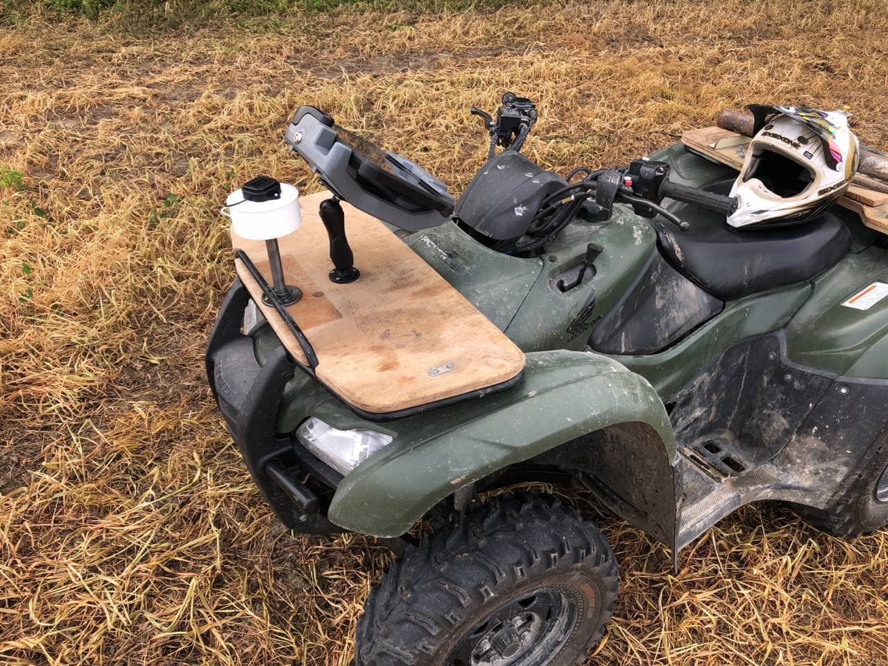
I also use an ATV and F9P. My antenna is barely above the rack so that roll isn’t so much of a factor. My F9P/antenna contraption is battery powered with bluetooth. I can connect it to my autosteer tablet and AgOpenGPS, or to an android phone running SW Maps. I can also easily hand-hold my F9P/Antenna to hold it above fence posts, rocks, etc. I post process on my desktop with QGIS.
I often think the ATV needs something to act like a planter marker, maybe a wooden stick on the front rack that hangs 5’ off the side and drags a chain. I also often wish that the ATV had autosteer, so that after post processing I could go back and autosteer the boundary to verify.
I have idle plans to put autosteer into my Hilux to test lines too, we have trimble ezsteer set ups in land Cruiser utes and hiluxs at work for doing crop trial work, so i know that if i could make a WAS work its all possible. I may yet rig up some sort of out rigger off the front and run and offset for it, but I have done plenty of Greenstar boundary mapping with a similar set up to this with no issues.
A setting in the app to “lock” WAS to 0 degrees for non steering applications like this would be pretty handy I think, would save any messing around with resistors or other extra hardware
Some work has been done for the “broken WAS” scenario but I can’t recall what. I think the latest AIO firmwares will automatically send 0 degrees?. Or maybe it’s in AOG? I can’t recall. Ted’s trick is a great one to know (I didn’t know it).
I’m sure you already know but the Trimble EZ steer works great with AgOpenGPS. I have one in a tractor with an AIO micro board.
That Honda in my picture has electric power steering. The motor part is separate from the torque sensor/driver part and just has a big 2 wire plug on it. I did some investigating and I think it could be used for autosteer: Telegram: View @agopengpsinternational
My antenna is on an aluminium stick at the rack level at the side of the quad-bike and a chain hanging under the antenna. The chain is not that much needed when the antenna is so low and roll isn’t too much of an issue.
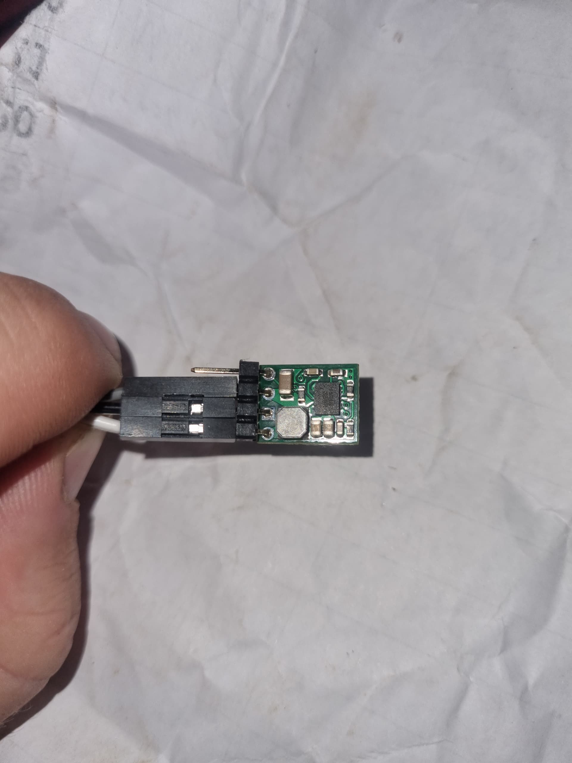
For anyone playing at home. I have found a 5v to 2.5v step down converter, will link below, that in my testing has been good to zero the wheels, i will eventually encase it in a non conductive resin to seal it and pin a 3 pin deutsch plug to match my WAS pin outs. It will be used in any situation where steering isnt needed and it can just center the wheels to keep it all happy. It is accurate to within 2°!