I recorded all the field boundaries while planting in the autumn hoping to drive a boundary contour in the spring with sprayer or fert spreader but they have all shifted by several metres.
I was using a neighbour’s RTK signal in the autumn and have since built my own base broadcasting to RTK2go.
Not sure what has made them move,base or rover inaccuracies?
Most likely one or both of your RTK base locations were off slightly. Then, when you switched bases, the boundaries were off.
If you have your base set to fixed location, and record your boundaries again, they should never change.
1 Like
Or connect the rover to the antenna from the base, borrow the correction again from a neighbor, write down the coordinates, enter them as fixed for the base and then everything will match again
1 Like
Okay,thanks both.
I can still connect to the neighbours base and boundaries have shifted.
Maybe they have surveyed in again and moved position?
I left my base to survey again for three days recently but the 3d accuracy was only showing about 1.2 metres.
Would this be a problem or as long as I entered the coordinates in the fixed base setting does it matter?
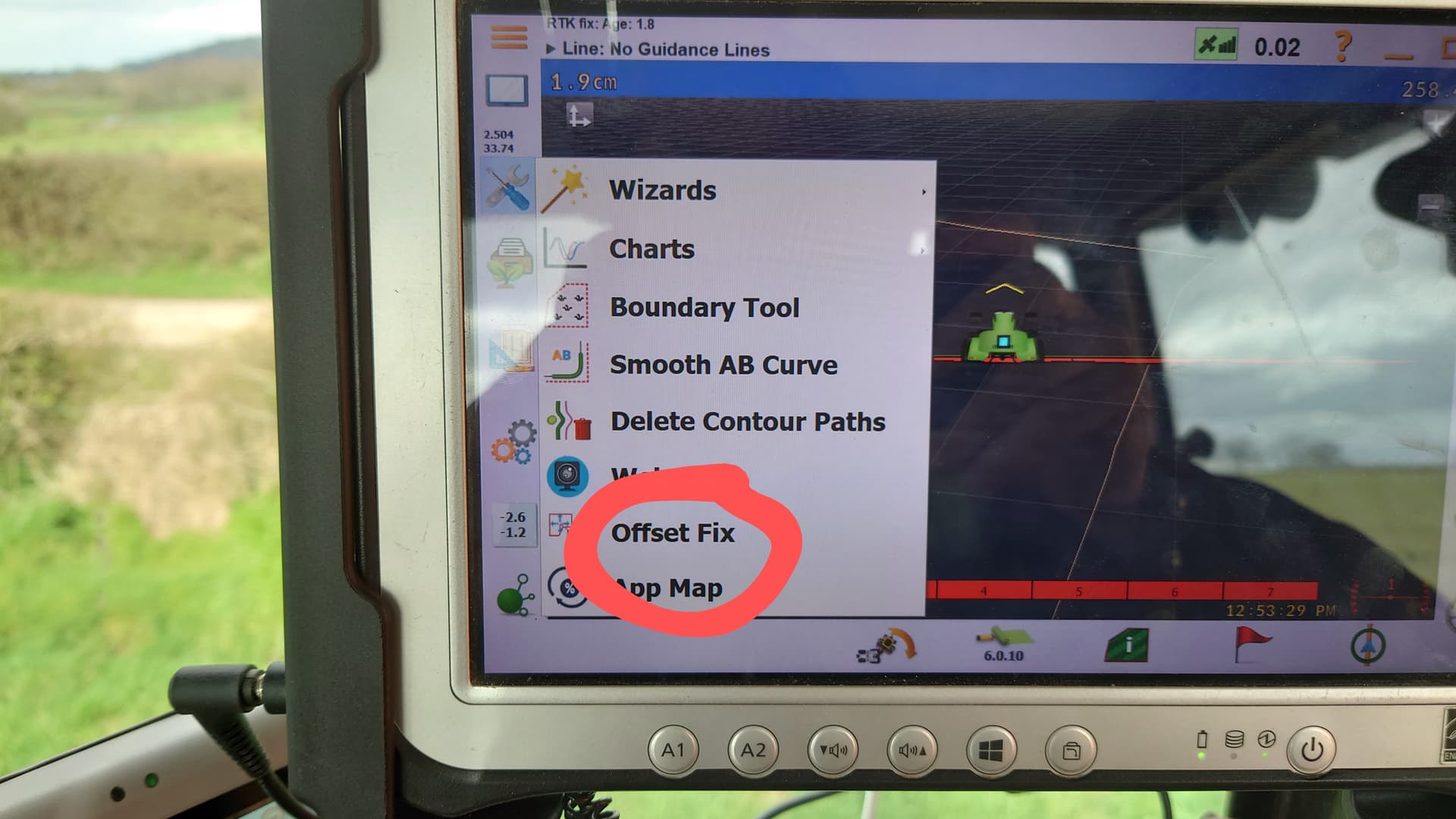
ok then is there a way to shift boundaries to compensate for this issue?
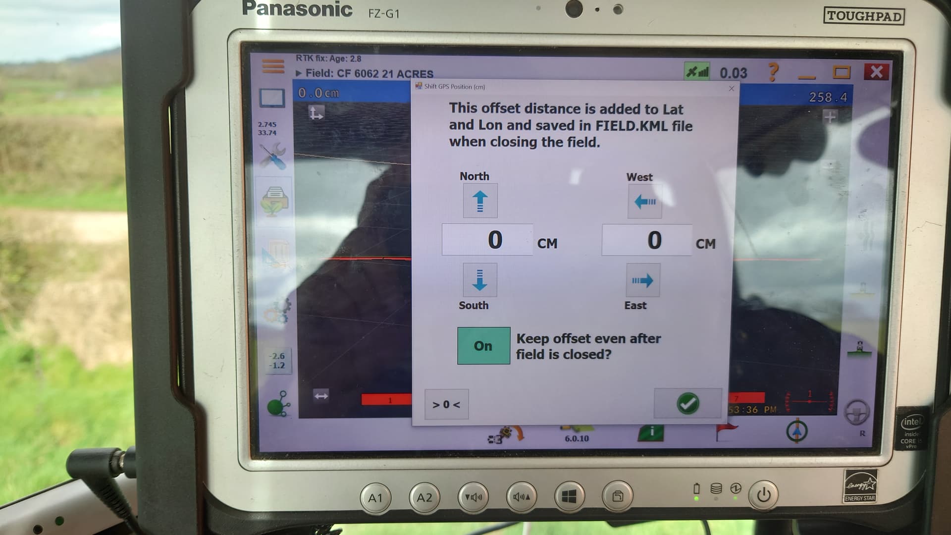
ive tried that but things dont move either