I’m trying to determine if this software is right for my needs (verison 5.6.2). Im trying to bring in a .KML file (written from Carlson software) into agGPS with lines that i need to follow to install drainage tile. I need it to bring in a designed .KMLfile and have these lines also. When I bring int he .kml filw i have a boundry but nothing in between. I’m also not sure about .XML files.
In its current release, it cannot follow a kml line. It has been hacked to follow a kml path, but the elevations would better fit the opengade 3d. It would need to be modified to do that as well.
Okay thank you its good to know that. Is there any way to know if its in the works in order to not have to hack it? I have a simulator verison of opengrade 3d from them but its a mess. I cant find out if i can even make a .adg file or use a .xml file which i was told i could and there is no help option etc. Sorry if these are dumb questions etc.
From whom? “They” said it would read .xml? Unless they modified it, it will only read .agd and only build a cut/fill map.
I do not believe there are any current plans to add kml following to AOG. I personally have built a hack that converted a kml to a recorded path. It worked very well in the simulator. As far as open grade goes, I’m not sure. @Pat would know more, I left off the discussion on OpenGrade awhile back.
Hello Kent;
These sentences got me excited, because I want to create the registered path for my robot myself, for example, I want to manually create a round-trip line in a kml file and transfer it to AOG, and I want my vehicle to move on these lines, is it possible?
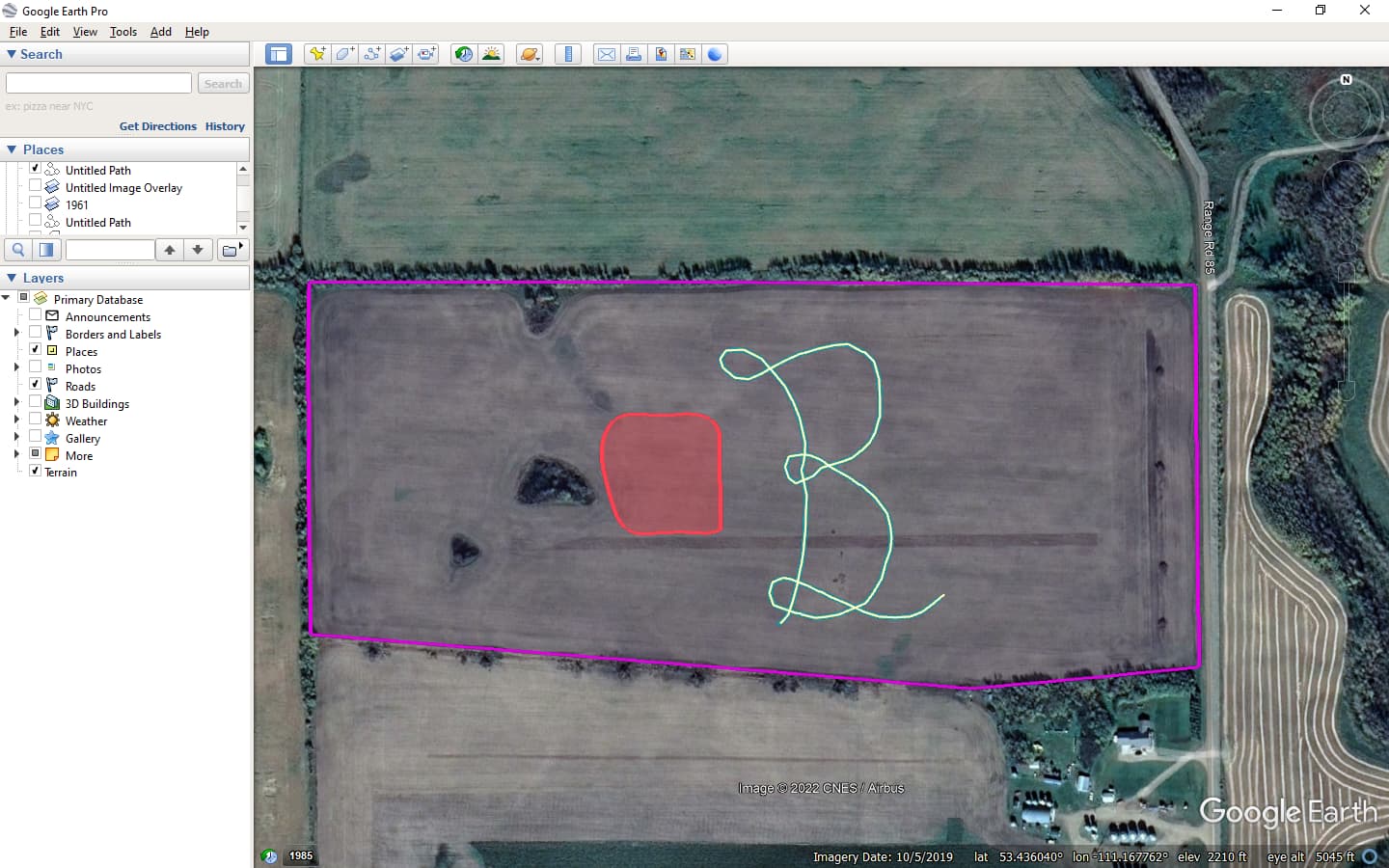
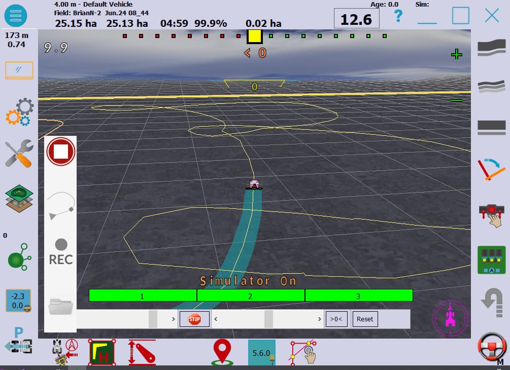
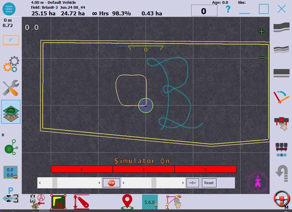
Very possible. I’ve done it in the simulator in a hack. I drew the kml path in Google earth and imported it into AOG. You must pay attention how sharp your kml file turns
Thank you for your answer, but I don’t know how to do this, can you guide me, or is there a ready-made program.
Try to do this search on YouTube
kml file agopengps.discourse.group
1 Like
My goal is not to create a border or a field, I just want to create a registered path with the mouse, unfortunately I couldn’t find anything on youtube.
I will attempt to find my hack in my archives. If so, I will add it to the latest version and post it here. It will be a few days before I can.
1 Like
Great excellent, thank you very much, I wonder if I can run it with AOG MicroOpenGPS.
Not yet. This is build into the latest branch “Section Control”. Cleaning up some of the functions.
Ok, thanks again for your hard work. I would like to try it soon.
Here it is to try. It is the FollowMe Branch. I’ll leave it up a day or so.
2 Likes
Yes, you can. Here is how. When you use this program in a field, load the line you need from the kml. When you see the line on AOG, close the program. Open micro, and you open the same field in micro, the recorded path should load.
So with this hack i have to draw it in google earth and then save it into the .kml file? if so im more looking to use the existing lines i have in a carlson file (.dwg). accuracy is very important and im not sure a mouse would be accurate enough. I am also not experienced with Github or Coding.
From the customer service email i got off a graigslist ad my father found. The verison is OpenGrade3D 1.1.1 and then i got a copy of Ag Open Gps (v5.6.2). not sure i have a good version of opengrade.
You can convert dwg files to kml. Autodesk civil will do it for you. There are some online converters as well.
But you will need to open file in Google Earth and save to a kml from Google earth. All kml files are not the same. Save file in the field you will be operating in.