So for my second question, what does the button do? I am unable to find a reference to it anywhere and I seem unable to figure it out on my own.
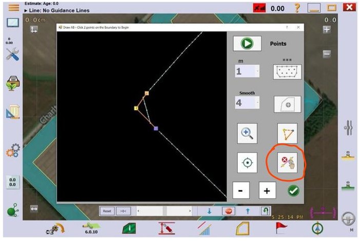
That button erased all points between two points you select. Let’s say you drove in your boundary by hand. You would then have a slight wave in the boundary as no one can drive perfectly straight. Now say you wanted to make that side of the field perfectly straight. You would select one point on one end of the section of boundary line you want straight, then select another point at the other end of the section you want straight. Then when you click the button you were asking about, all the point between the selected points would be deleted, then AgOpenGPS would draw a perfectly straight line between your two selected points making a straight section of boundary.
Thank you. So that’s why when I tried to delete a relatively straight line with it I couldn’t figure out what was happening.