This is about giving a precise amount of water to the entire field in a controlled manner to maximize the yield of row crops. It is also for rice levees where the field is flooded from one corner and then gates in the levees are closed to let the water sit for a few days . With a 0.1% grade I believe the levees are 100ft apart. I kinda figured you might be talking about something like the levees but I wasn’t sure.
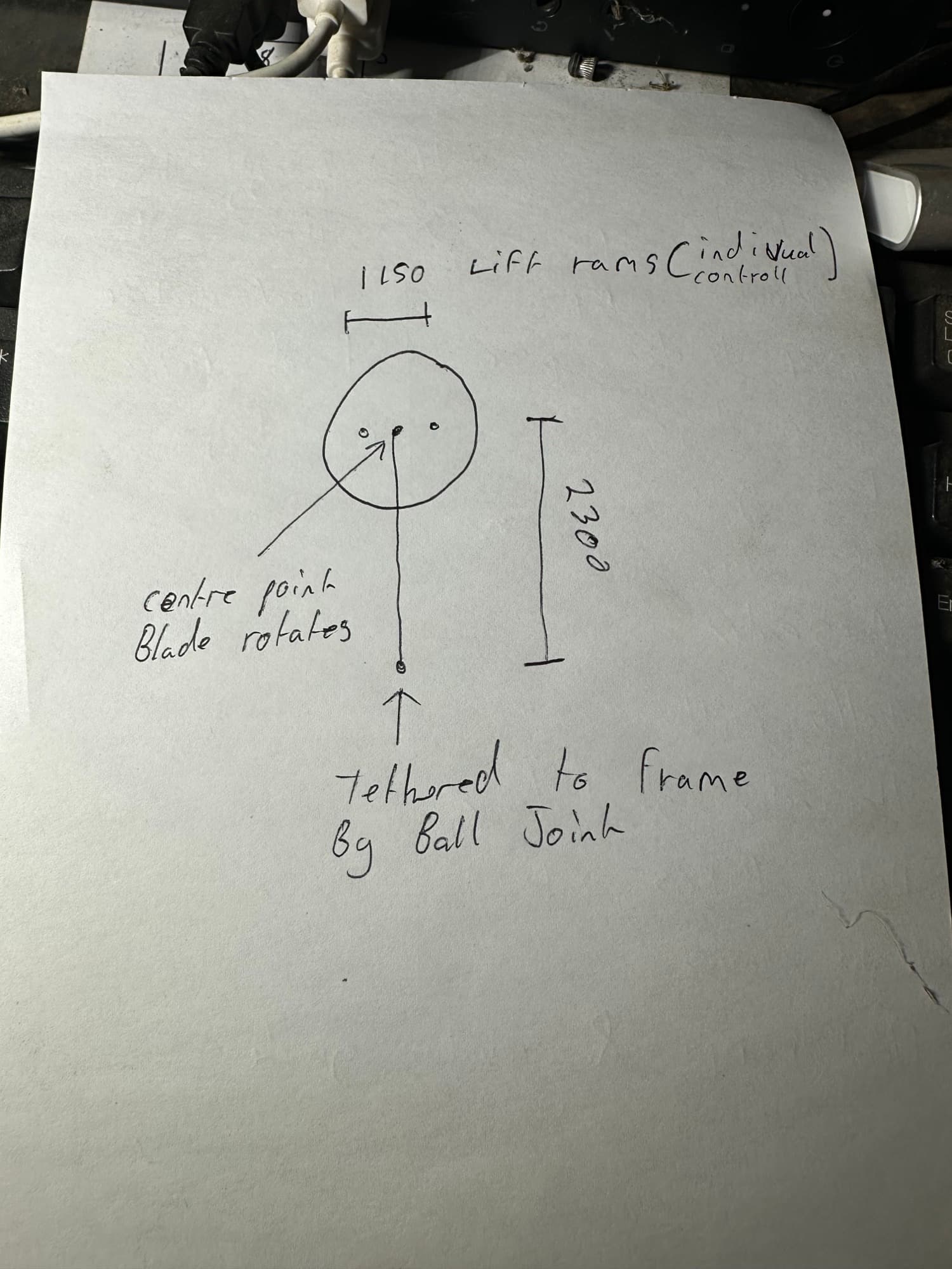
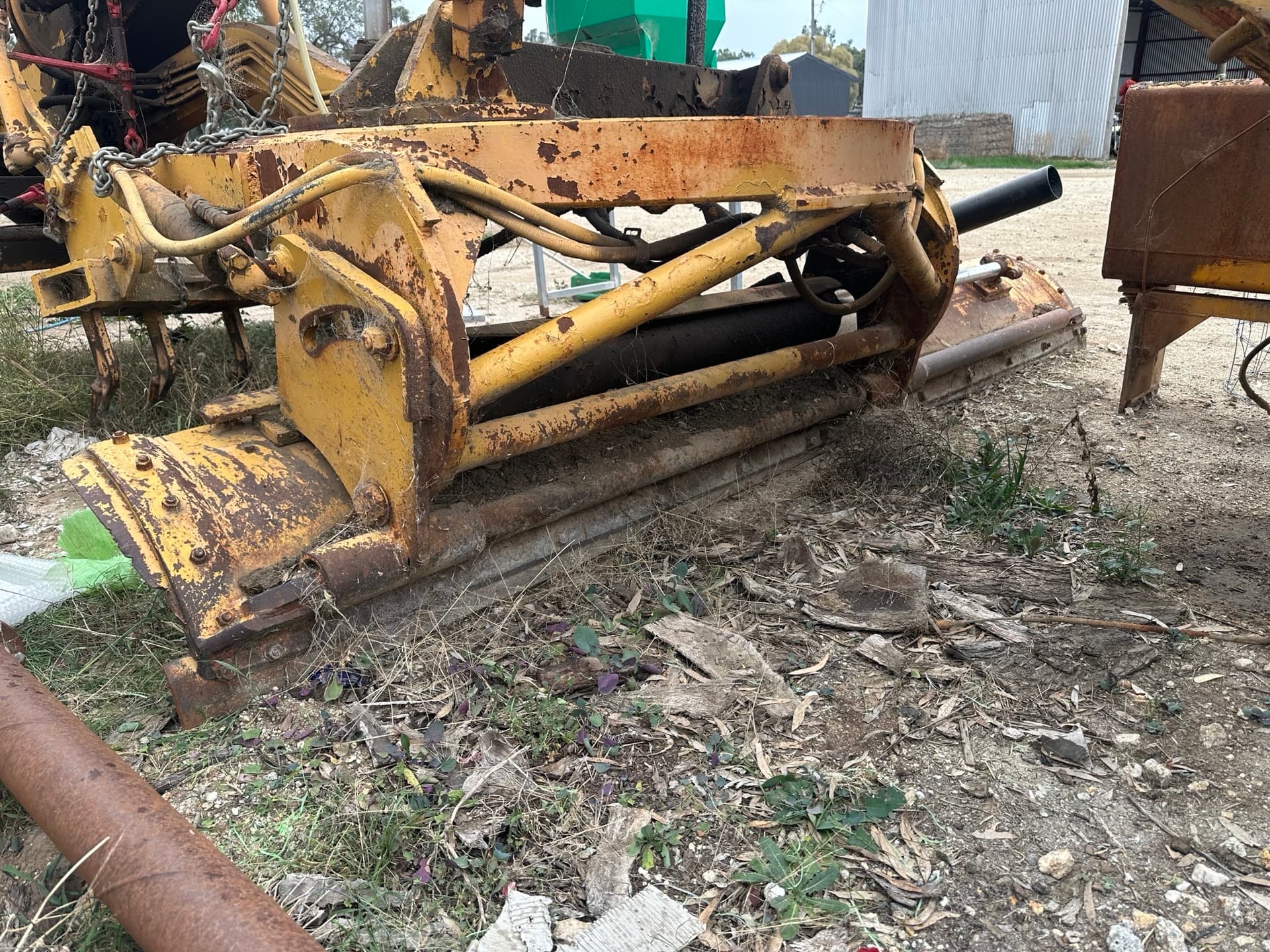
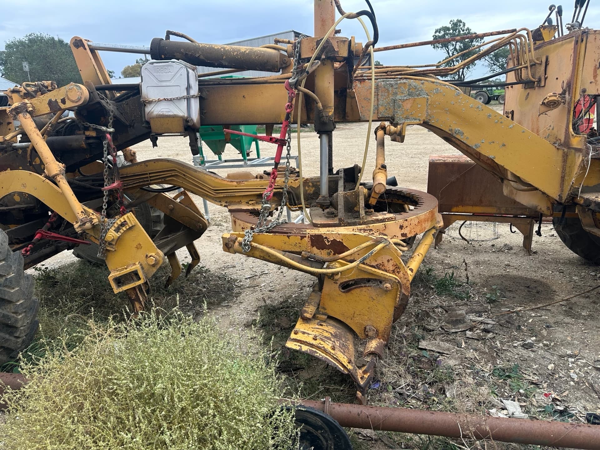
I am wondering if I can create a mock-up of a grader blade using wood and DC motors. I need to research the linkages used because I have never seen a grader up close. Let me know when you are able to help with this aspect of AgGrade.
Yeah, irrigation of row crops. Here we will flood the bay until it reaches the end of the bay, where it will be shut off, and excess water will sometimes be drained into a recirculation drainage system, so it can be pumped back into the supply channel for use elsewhere. If this is already known to you, sorry, I am reexplaining. I find that there can be some unexpected differences between Australia and other countries.
The blade width is 3650mm
The blade can side shift (slide from side to side along its length)
At the moment, I can’t make a video of it moving (See photo below), but if you want a video of me explaining the movements, I can. I am currently busy preparing and fixing equipment for the sowing season. So the hydrostatic upgrade has to wait.
I have managed to create an approximation of the haul algorithm in OptiSurface using nothing more than the input parameters in the dialog window and an understanding of the general problem. I had no internal or privileged knowledge. The output is not an exact match, but it is very close. I would like to include this in AgGrade and perhaps an open-source standalone tool.
However… OptiSurface says “Patent Pending” for their haul algorithm, both on their website and in the haul output. I did a search in the Australian Patent system and in 2021 they filed a provisional patent:
however it says it has “lapsed” which means (to my understanding) they never went through with it.
I contacted them:
Would you be willing to confirm whether there are any current published or pending patent applications, or issued patents, that relate to that provisional or to OptiHaul / haul path analysis? If so, the application or patent numbers would be very helpful. Thank you.
to which they replied this, instead of the patent number:
What is your interest with OptiHaul?
I asked again but they didn’t reply. I would have thought if it was patent protected they would be keen to show me the patent number, but they didn’t confirm or deny anything.
I searched for “Davco” (assignee) and “Graeme Cox” (inventor) in the US Patent database and couldn’t find anything related to hauling soil.
So…what to do? I obviously have no budget for this, just want to release the code so others can use it for free.
I presume that they didn’t go through with it because they didn’t want to reveal the algorithm. I also presume once I publish this they wouldn’t be able to file for a patent in the future.
I haven’t had a good look at the patent laws but it looks like if you didn’t base your code directly off their code or follow their algorithm blocks/flow you should be ok. And there is the fact that they don’t have an active patent. I suppose if you voice your ideas about what you are thinking while developing the software on the form it acts as evidence that you weren’t directly coping their code.
I did a patent search of my own and I cannot find anything. Starting to think it will be OK to publish this. Australian patents (even if they had one) are not valid in the US anyway.
The haul analysis in OptiSurface is mostly useless because there is no way to get any usable data out of it. The only thing that can be extracted are georeferenced images of the arrows. Also during my work on this I started to have a strong suspicion that the OptiSurface haul times do not include turns or driving back over the last fill to compact it, so they may be underestimations.
My algorithm beats the OptiSurface one for time on a like-for-like basis, but then I have to add in those two extra things, so it ends up coming out as a bit more time.
For my test field with 46,000 cu yds:
OptiSurface = 199.5h (suspect no turns or compaction)
Mine = 205.0h (with turns and compaction)
I am now toying with the idea of creating am open source Windows/macOS application called “AgGrade Designer” that allows a user to load in survey data, create a planar design, then visualize and evaluate various haul options, with ponding analysis and a complete GPS guidance export.
Any thoughts on this would be welcome!
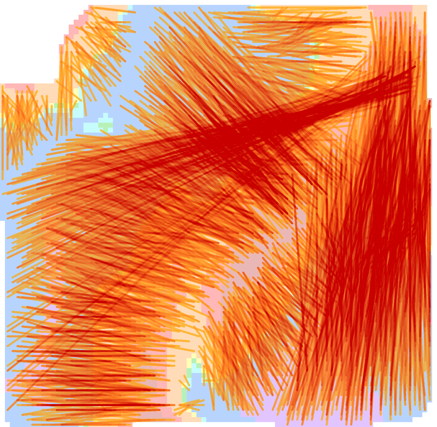
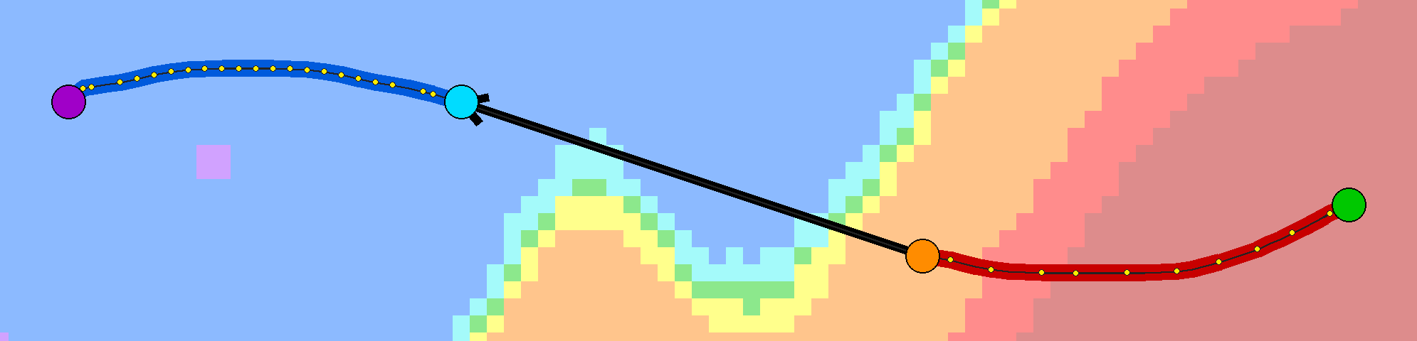
Image of a calculated cut and fill pair with GPS guidance (yellow dots):
I’m not too sure how hard it would be, but an idea I had was to have a height-basted layer map with the hall paths numbered, and when you do a cut that matches a cut path, it counts as done and disappears off the GPS screen
Also, the map could act as a height reference, so it could control the height of the buckets (pans). You probably would need a setting of variance on the GPS to allow for tractor traction