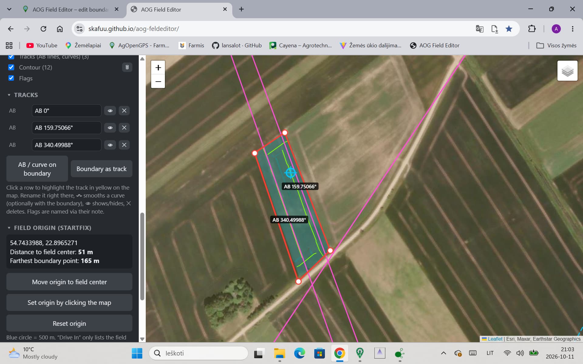
Nothing to install: open the link in Chrome or Edge, pick your Documents\AgOpenGPS\Fields folder once, and click a field. Your field data never leaves your computer. The page reads and writes the files in the folder you choose, nothing is uploaded.
The interface is in English and German. It follows your browser language, and you can switch with DE | EN at the top.
What it does
Edit the boundary point by point on a satellite map: drag points, click the line to insert a point, right-click to delete. Inner boundaries too. When saving, the boundary is densified the same way AOG does it, so the U-turn line is built correctly. Fields with too few boundary points are detected and repaired.
Flags: add, move, delete, change color and note.
Move the field origin (StartFix), e.g. to the field center. All files in the field folder are converted along with it (boundary, headland, tracks, coverage, tramlines, recorded path …).
Background: “Drive In” only lists a field if you are within 500 m of its StartFix. StartFix is where you pressed “New” when the field was created, often the farm yard. The editor shows that 500 m circle.
Show everything the field contains, each with an on/off checkbox: coverage (with ha), AB lines and curves, headland, headland lines, tramlines, contour, recorded path, AOG background image.
Rename AB lines, curves and headland lines. Only the name line in the file changes.
Please note
Close the field in AOG before saving. AOG saves when it closes the field and would overwrite your changes.
After changing the boundary, rebuild the headland in AOG.
Before every save the old files are copied to a Backup_<date> subfolder in the field folder. For your first tries, still use a copy of a field.
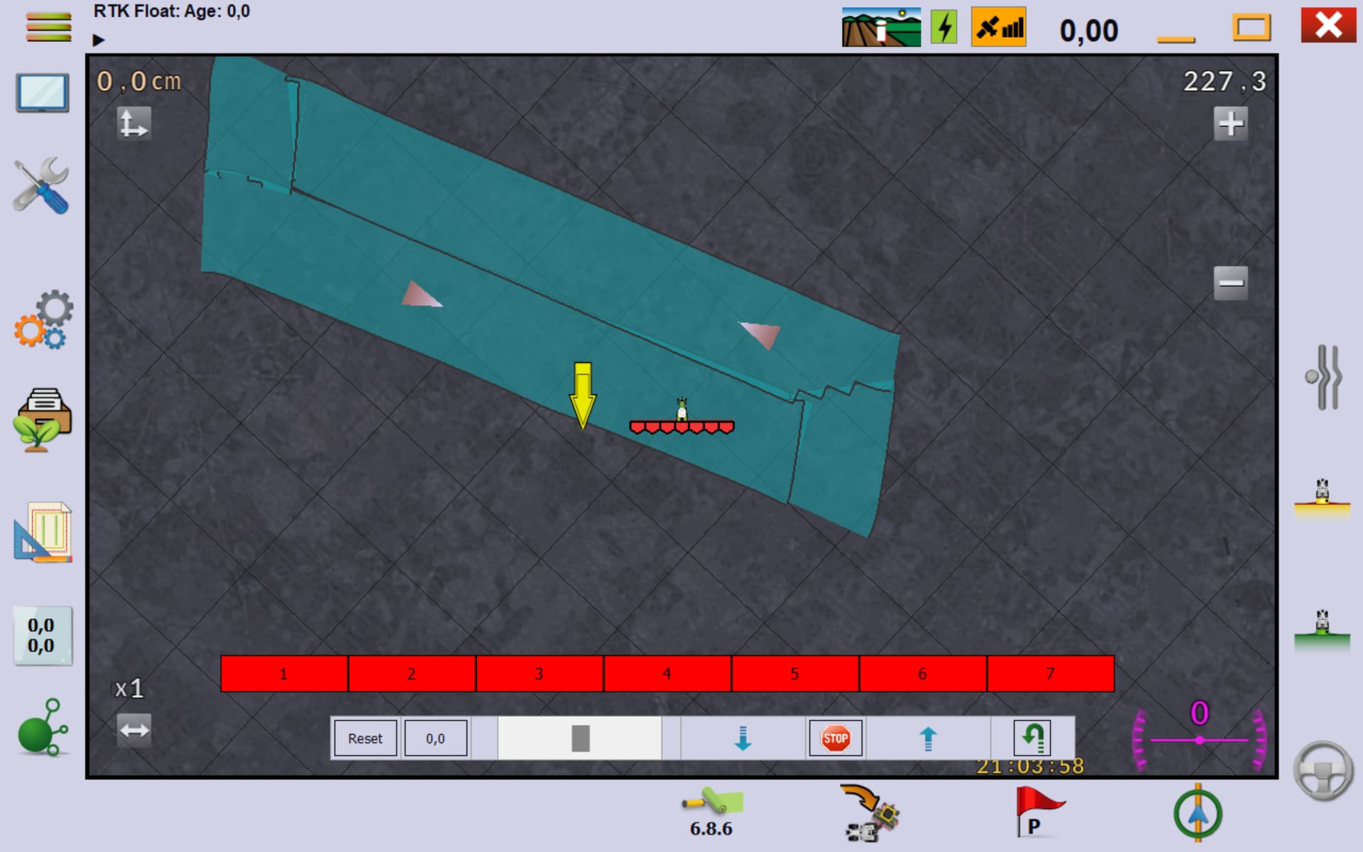
File formats follow the current AgOpenGPS source and were tested with my own fields on AgOpenGPS 6.8.6. Older versions or AgOpenWeb fields may differ. Please tell me if something looks wrong.
Feedback, bugs and ideas are very welcome, here or as a GitHub issue. If a field doesn’t load or looks wrong after saving, the files from that field help a lot.
Thanks!
Kurz auf Deutsch: Browser-Editor für AgOpenGPS-Felder: Grenzpunkte verschieben, einfügen und löschen, Fahnen bearbeiten, Feld-Ursprung verschieben (wichtig für „Drive In“), alle Ebenen ein- und ausblenden, Spuren umbenennen. Kein Download nötig, die Daten bleiben auf dem eigenen PC. Oberfläche auf Deutsch und Englisch. Vor dem Speichern das Feld in AOG schließen. Rückmeldungen gern hier oder auf GitHub.
Excellent. I was building something nasty in excel but gave up!
I wonder if it would be possible to create a curve between 2 points? A bit like the shapes tool in MS Powerpoint? Driving a curve creates lots of wiggles, but a straight line wastes area.
New field… – create a complete new field like in AOG: name it, click the outer boundary on the map, save. The origin goes to the field center, so “Drive In” finds it.
New outer / inner boundary – draw boundaries in existing fields.
All boundaries are listed: click to edit, show/hide, ✕ delete. Inner boundaries can be set to drive-through.
A dashed “ghost” shows where a point and the boundary were before you moved them.
Tracks
AB / curve on boundary – like “Draw AB” in AOG: click two points that snap to the boundary, then make an AB line or a curve following the boundary.
Boundary as track – turns a boundary into a “Boundary Curve”.
Smooth – smooth a curve or boundary track, either whole or only between two points. That section is replaced by a smooth arc without a kink.
Rename, show/hide and delete AB lines, curves and headland lines.
Display
Every layer can be deleted completely with (coverage like “Delete applied area” in AOG, contour, tramlines, recorded path, headland …).
Overlapping coverage gets darker instead of disappearing.
The sidebar sections can be collapsed.
As before: close the field in AOG before saving, and the old files are copied to a Backup_… folder. Feedback and bug reports are very welcome!
Kurz auf Deutsch: Neue Version online: neues Feld anlegen, Grenzen zeichnen (Innengrenzen auch befahrbar), AB/Kurve an der Grenze wie in AOG, Grenze als Spur, Kurven ganz oder abschnittsweise glätten, Spuren und Ebenen löschen. Danke für die Vorschläge!
Done, thanks for the idea! In the new version every AB line, curve and headland line has a ✕ to delete it. In “Show” you can also delete whole layers with – coverage, contour, tramlines, recorded path, headland and more.
If you meant a different kind of line, just tell me.
Yes, that’s possible now! New field… creates a complete new field like in AOG: give it a name, click the outer boundary on the map and save. The editor writes the same files AOG creates and puts the origin in the field center, so “Drive In” finds the field.
In existing fields you can draw a new outer or inner boundary, and inner boundaries can be marked as drive-through. Let me know how it works for you!
AB / curve on boundary – click two points that snap to the boundary, then choose “Curve along boundary”. You get a curve that follows the field edge, without the wiggles from driving it.
Smooth – works on any curve. Click two points on the curve and only that section is replaced by a smooth arc that joins the rest without a kink. So you can follow the edge and then round off a single corner. The slider sets how wide the arc swings.
Would be great to hear if that works for your fields!
I expect I’ll copy the data points from a settled boundary curve back to the boundary file to ensure the boundary, boundary curve and headlands are consistent to avoid any confusion with the section control.
Hey, thanks for the idea! I added it in the new version.
When you smooth a boundary curve (or a curve you made along the boundary) there’s now a checkbox “Move boundary too”. If it’s ticked, the boundary points get moved along with the smoothed curve. Works for the whole curve or just a section, e.g. only one corner. Clicks snap to the boundary points so you can pick exactly where it starts and ends.
So no need to copy the points by hand anymore. Just save and rebuild the headland in AOG afterwards. Ctrl+Z if you don’t like it.
I think I see the problem: on your screenshots AOG and the editor are open at the same time and the field is loaded in AOG. AOG only reads the files when you open the field, so it doesn’t see what the editor saved. And when AOG closes the field it saves its own version again, which can overwrite the new boundary.
Can you try it like this:
In AOG close the field (or close AOG completely)
In the editor draw the boundary and click “Save changes”. There should be a green message at the bottom saying which files were saved
Now open the field in AOG again
If you reload the field in the editor after saving you should see a lot more points. If you still only see your 4 points after reloading, then the save didn’t work. In that case please send me a screenshot of the message at the bottom after saving.
Update – big new version online (same link: AOG Feldeditor)
Lots of changes since my last post, so here is a summary:
New look
Toolbar with tabs like in Office: Field, Boundary, Tracks, Headland, Tramlines, Flags & Measure. Each tab only shows its own tools and layers.
Every tool opens in the side panel and works the same way: pick, set the values, check the preview on the map, apply. No more pop-ups.
Headland
Build around – same calculation as “Build Around” in AOG, optional with rounded corners.
Build from lines – click curves, straight lines or existing tracks, each line gets its own distance (metres or tool widths). Field sides can also be detected automatically. The headland is built from where the lines cross, so you can make e.g. only the two headland ends.
Tramlines
Vehicle and tool are read from your AgOpenGPS profiles (track width, tool width, sprayer width).
Along line – from one or two tracks, number per side or up to the edge. Where two sets cross they get trimmed, you choose which one.
Boundary tram – one or more rings around the field with corner radius.
Delete single tramlines, replace or add, show the working width as an area.
I checked it against tramlines AOG made on my fields: same lines within 0–2 cm.
Measure
Distance and area snap to boundary points, flags, the boundary and at 90° to the boundary, so you can measure the field width exactly.
New angle tool: click two tracks or field sides and you get the angle between them (for curves the line from start to end counts).
Other things
Click tracks right on the map to select them.
Smoothing with slider, can move the boundary along.
A boundary track can be used as the field boundary.
Flags in a list, click to open the options.
As always: close the field in AOG before saving, the old files go to a Backup_… folder. Please tell me if something doesn’t work on your fields, especially headland and tramlines on odd-shaped fields!
Kurz auf Deutsch: Große neue Version: neue Oberfläche mit Registern, Vorgewende (rundum wie AOG oder aus Linien mit eigenem Abstand), Fahrgassen wie „Tramlines Multi“ mit Fahrzeug und Gerät aus den AOG-Profilen, Randfahrgassen, Messen mit Einrasten und neues Winkel-Werkzeug. Rückmeldungen gern!
 Kurz auf Deutsch: Browser-Editor für AgOpenGPS-Felder: Grenzpunkte verschieben, einfügen und löschen, Fahnen bearbeiten, Feld-Ursprung verschieben (wichtig für „Drive In“), alle Ebenen ein- und ausblenden, Spuren umbenennen. Kein Download nötig, die Daten bleiben auf dem eigenen PC. Oberfläche auf Deutsch und Englisch. Vor dem Speichern das Feld in AOG schließen. Rückmeldungen gern hier oder auf GitHub.
 show/hide, ✕ delete. Inner boundaries can be set to drive-through.
 Smooth – smooth a curve or boundary track, either whole or only between two points. That section is replaced by a smooth arc without a kink.
 (coverage like “Delete applied area” in AOG, contour, tramlines, recorded path, headland …).
 Kurz auf Deutsch: Neue Version online: neues Feld anlegen, Grenzen zeichnen (Innengrenzen auch befahrbar), AB/Kurve an der Grenze wie in AOG, Grenze als Spur, Kurven ganz oder abschnittsweise glätten, Spuren und Ebenen löschen. Danke für die Vorschläge!