Hi, New to this forum but been using greenstar Muller and Blackbox for many years and like the idea of learning more about gps systems. It seems that you are all pretty advanced in doing this but the one thing that I have yet to find is a way of automatically creating the most efficient A-B operations line from a mapped field. Is this feature on the software or does anyone have another software option that can create these, even a phone app. Appreciate it may simply create an A+ heading type line instead and I can do this manually from Google earth, but that wont necessarily be the optimum for the field.
I know in most countries there are usually nice straight field edges but here in the SW UK we have fields shaped like a dog’s hind leg !
If you have recorded your boundary, you can spend all winter in simulator figuring out your most ideal AB lines. The boundary lets you visualize the field and figure out exactly where the other end of the A+ line will end.
The AB lines are stored separately for each field, so you will always have them. You can also toggle trough all of your stored AB lines on the fly by hitting the switch ab line button.
2 Likes
AgLeader SMS is able to use the boundary to calculate/create AB lines for “least passes.” There’s a free trial of the software, but I don’t know if the free trial has that capability. That’d be worth exploring.
A free software that I have used in the past for creating drone missions is ArduPilot Mission Planner. Flying a plane back and forth in lines spaced x feet apart to take pictures isn’t all that different than tractor autosteer AB lines. You can create a boundary and tell it how far apart to space the flight paths, the software will automatically generate a least-passes approach. The routes are optimized for flight paths and I don’t know how well that would translate to tractor paths.
For either of those softwares I don’t think you are going to be importing/exporting with AOG, just manually copy/pasting the heading angle.
You are probably going to want curves though? I don’t think there is a software that will automatically calculate/create the most efficient curves?
1 Like
Try this page, it calculates the best orientation for the lines. You can also make them following the edge that you want.
https://app.geo-bird.com/home
5 Likes
That’s great, thanks, you can easily download the KML file from the other section at the bottom, is there any download limit? Do you know
Tried this on a couple of fields but I’m getting “Error reading KML, Choose or build a different one” when importing .kml to v5.7.2
I did just that and its a great piece of software. Manually plotted a boundary around one of my fields and it came up with and angle of flight almost identical to one I had spent ages manually sorting in MyJohnDeere software and Google Earth.
MyJD can now export shp files but sadly they appear incompatible with Mission Planner at the moment and either come up with error listing or simply not loadable. Trying to find a work around though.
1 Like
Hi Hugh
Any chance of a copy of the sample exported shapefiles so I can take a look? Cheers
Again a great piece of software giving a number of options for farm operations. Much simpler and quicker than Mission Planner. Frustrating that as yet the line export files dont seem to be able to send to John Deere yet. They claim to be ISOXML able but in reality I could send the zip file to MyJD and it appeared to import but in reality it didnt and if sending the unzipped xml file there, it would reject it. Would be OK if it just told you the heading of the AB lines like Mission planner because at least you can do an A+ heading on the tractor steering. There is a workaround by exporting to Google earth then the line can be overplotted manually which will give you the heading.
I tried to open a saved kml with Geo-bird in AOG 5.6 but it fails to open.
I have the same problem with KLM files exported from Qgis. I wonder if it is a attribute table format problem or something else? Who knows what AOG expects from a .KLM?
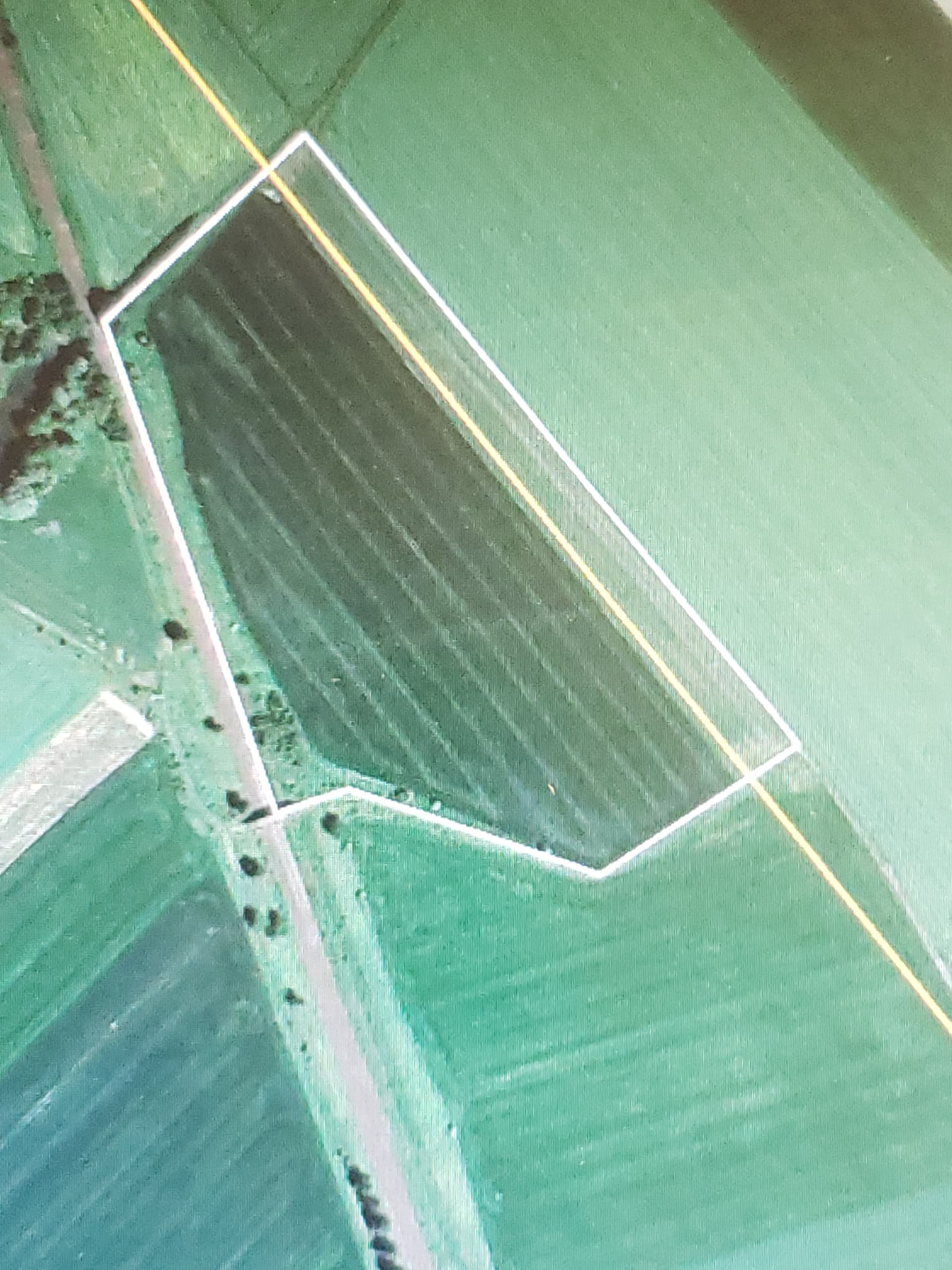
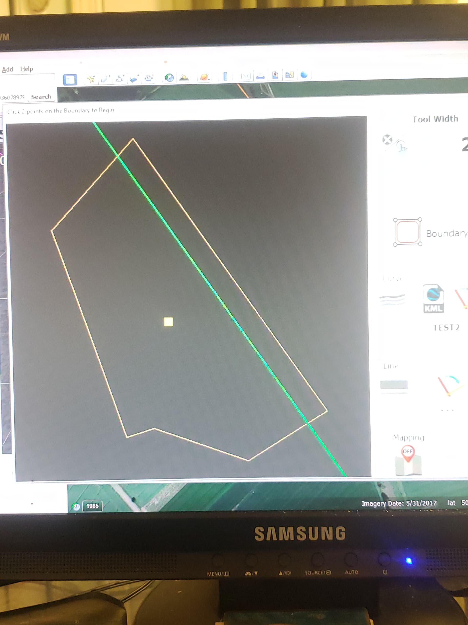
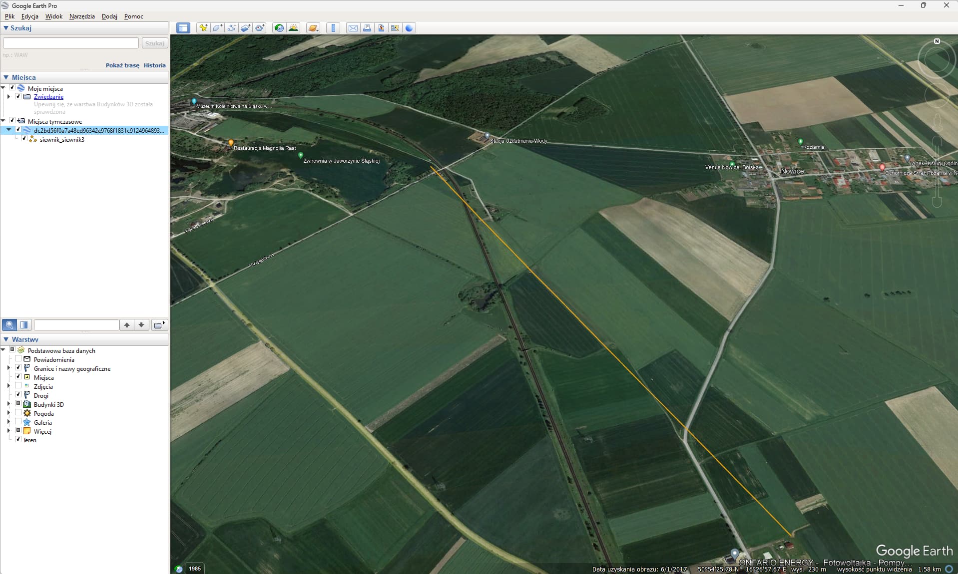
Here is a geo-bird boundary and ab line imported after saving each out of GE. There is an overlap of the abline.

I found the problem today. Qgis had inserted a Z-dimension in the .KLM and I had to re-export the files an untick the include z dimension box to turn it from polygonZ to polygon type.
2 Likes
FJDynamics were doing an electric robot lawnmower demo locally to me today and that would calculate the most efficient A-B from a boundary map.
A lawnmower does not have many constraints but I’m sure one can still argue about the definition of a most efficient A-B line for a given boundary. How did FJD define it?
Tried opening fields created in GEO-BIRD but I’m getting “Error reading KML, Choose or build a different one” when importing .kml to v5.7.2. What am I doing wrong?
I can’t find any settings to change in GEO-BIRD.
How did you get the GEO-BIRD .kml to open in AOG?
Open the kml file in Google earth. Save as while in Google earth. Then attempt to open it in AOG.
AOG is looking for a specific kml structure. Google earth is more forgiving in the file structure.
Can You help?
I had tried to open KML file in Google earth pro and then save as.
AOG still can not open it.
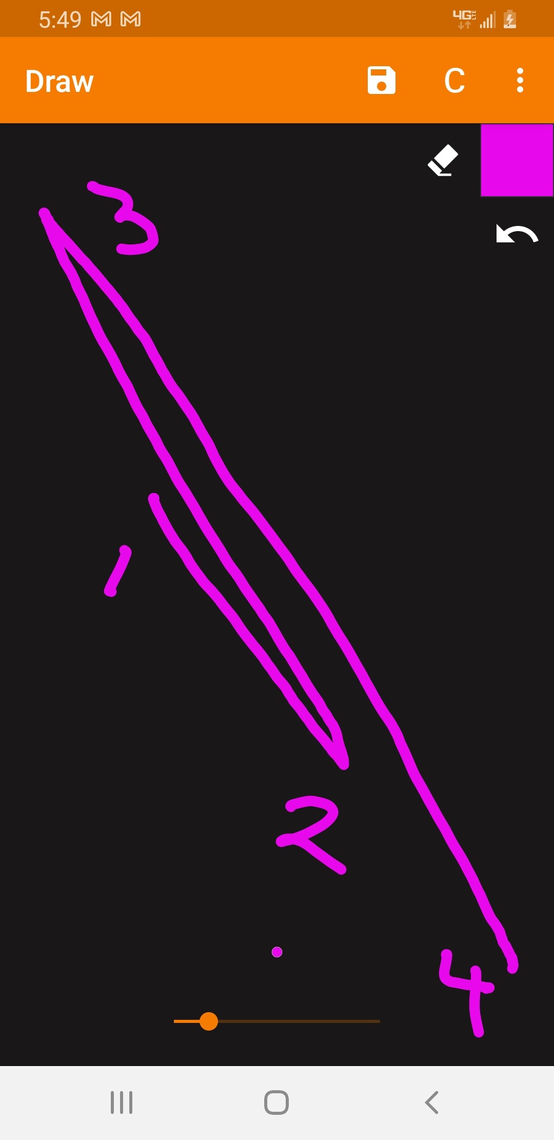
The file contains only 1 tramline
here is the source of file
<?xml version="1.0" encoding="UTF-8"?>
<kml xmlns="http://www.opengis.net/kml/2.2" xmlns:gx="http://www.google.com/kml/ext/2.2" xmlns:kml="http://www.opengis.net/kml/2.2" xmlns:atom="http://www.w3.org/2005/Atom">
<Document>
	<name>dc2bd56f0a7a48ed96342e9768f1831c91249648934287583210_TEST2.kml</name>
	<Style id="WaylineStyle">
		<BalloonStyle>
			<displayMode>hide</displayMode>
		</BalloonStyle>
		<LineStyle>
			<color>ff0d9eda</color>
			<width>2</width>
		</LineStyle>
	</Style>
	<Placemark id="2D14796B8E2D42C7DCBA">
		<name>siewnik_siewnik3</name>
		<styleUrl>#WaylineStyle</styleUrl>
		<ExtendedData>
			<Data name="WaylineType">
				<value>0</value>
			</Data>
			<Data name="WaylineVersion">
				<value>2</value>
			</Data>
			<Data name="WaylineSource">
				<value>2</value>
			</Data>
			<Data name="GisRefAlt">
				<value>0.0</value>
			</Data>
			<Data name="MapType">
				<value>1</value>
			</Data>
		</ExtendedData>
		<LineString>
			<tessellate>1</tessellate>
			<coordinates>
				16.45599517,50.90661087500002,0 16.458668339,50.90414680799999,0 16.45062572488181,50.91155933458103,0 16.46403607897986,50.89919797237739,0
			</coordinates>
		</LineString>
	</Placemark>
</Document>
</kml>
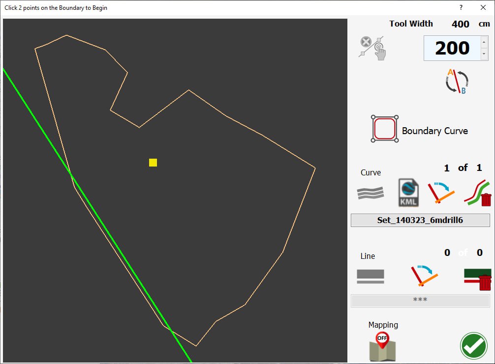
The latest version of AOG should import it as a curve. Might give it a try. Version 5.8.x