I’m overlooking a setting, can anyone help?
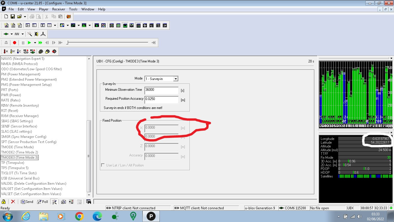
Setting up a base, Surveyed-In for 24 hours, got a stable XYZ fix, but when I want to go from Survey-In to FIXED, the Fixed positions are obviously the wrong format, correct to .4 decimal places.
Anyone know where the positionnal type is specified?
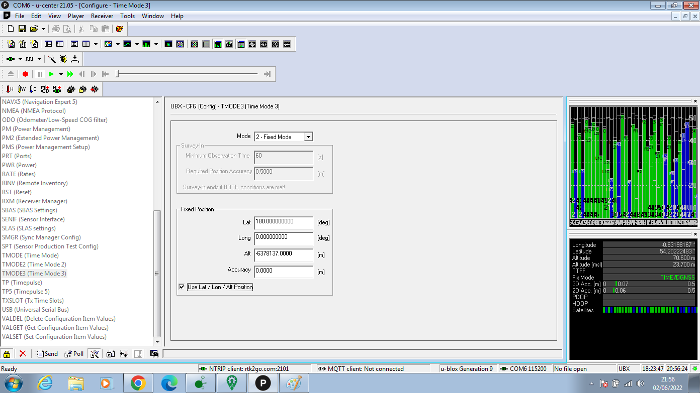
First change the Mode to “Fixed Mode” and then select " Use Lat / Lon / Alt Position" at the bottom.
You can now enter Coordinates int the correct format.
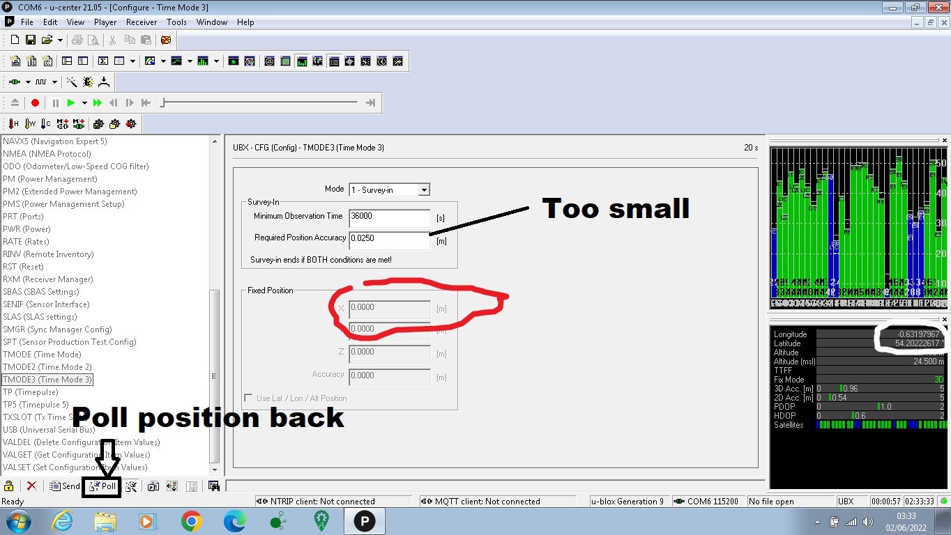
Press “Poll” button to read the current survey position.
Also, try to increase “Require Position Accuracy” higher . ( Because the survey can not be finish if F9P can not have accuracy as require.)
1 Like
I tried this and the values are invalid (like lat 99.999999, lon -89000000 and altitude of -37000m). Basically it thinks I am inside the earth’s core 
1 Like
Ah, ok.
I went small because I wanted CM level accuracy. I did wonder what that poll button is for. I’ll try it shortly.
Thanks guys.
edit: same result. surveyed in until it got a fix / TIME, then hit ckeckbox and i get this.
Enter your real location in the fixed position.
Tried, problem is that the coordinates can only be entered to 4 decimal places. It looks like it’s expecting the data in a different format…?
If i try to enter them manually, it offers the 4 decimal places, if I click the “Use lat / lon” checkbox, then it offers the full 9DP, but the data is wrong.
I’m missing something obvious here.
OK, if I check the box, then I can overwrite the automatically populated values with accurate ones to the correct DP, but the satellites have now gone blue which I assume isn’t good. The MSL value is completely wrong too, it should be about 24m.
Edit: Is the problem that the base station configs are written to output radio via UART rather that the USB / NTRIP method?
At this point your fixed location over rides the satellite data. You can now submit your corrections.
So that’s all how it should be?
I’ll swap over to RTKBase and give it a shot.
Thanks.
See if the corrections are being sent.
1 Like
That means a trip down to the garage at 1AM. Back in 10.
Looking good. The current fix is drifting a little, but I will set logging on for 24 hours and see how it performs. Will then look at RINEX corrections.
My mistake this time was assuming that the “Set Lat / Lon” checkbox populated the coordinates with the currently displayed values. Also thought that the blue satellites meant they weren’t updating correctly, assumed they had to be green.
Stupid mistakes, ended up chasing my tail once more.
Thanks again.
Another naive error was that I had thought that by setting a fixed position you were bolting down the coordinates of the base and so could not understand why the live coordinates still drift in real time. Obviously this is because the fix obtained in real time is only as good as the conditions at that time.
So what confuses me now is whether it’s actually desirable to get a highly accurate fixed position for the base? Are the sent RTK corrections broadcast from the specified fixed position of the base or the current GNSS coordinates? Or are the base station coordinates being used as an additional reference station?
Thinking aloud really, just trying to piece all this together, probably needlessly
You survey in to get an accurate base location. You can hire a survey to get this done also. What you need is a coordinate you are satisfied it is close enough. The corrections are more or less what is wrong with the current GPS reading at the base. Even the most accurate bases are off every signal as much as a couple of meters. Your rover needs to know how far off each satellite signal is coming in. The rover corrects each signal coming in by how far each satellite signal was off at the base. Rest assured, the base GPS is always wrong. It is only right because you tell it what it is supposed to be. This is the fixed position.
Your rover is where you are looking for a stable GPS, because it has been corrected.
2 Likes
Yes RTK is all about accurate relative positioning. Relative to the base station, which you’ve arbitrarily defined to be at a certain latitude, longitude, and elevation. I’ve often thought about making my base station consistent with local, commercial RTK systems (like my Deere dealer’s local RTK network), but then I realized it really doesn’t matter to me. There’s no such thing as absolute position anyway. Your farm is moving several centimetres a year relative to a point somewhere else on the globe.
How complicated would it be to setup a 2nd base, and have the two “synced” so that switching between the two would not cause a position jump?
Not really sure, other than to survey the second base station using the first as the base, and then making it an independent base station after that.
There is such thing as a “moving base” but I’m not sure how it fits in.
If you PPP your base you get position in ± 0.005 m range precision. If you PPP both bases at same time relative should be only 1 cm difference or jump with ±2.5cm nominal RTK precision hardly noticeable.
Yep, I get that there is no such thing as an absolute position in space, but surely regional ground based fixed points are relatively stable?
Another naive question, but why do we use satellite systems for local terrestrial tracking? I have been looking at the timing and environmental issues with satellite and the complicated corrections required to improve accuracy, so wouldn’t it be better and more reliable to triangulate from ground based base stations?
Whilst on a road unfamiliar to me, I reported an incident to the emergency services a while back and they had my phone position triangulated to within a metre within seconds simply by triangulation using phone masts and appropriate timings. Is the reason this is not available to Joe Public due to resourcing?
@m_elias, that’s my thinking. It’s what, £250 for a base station (RTK2B kit and pi), so £1,000 gets four. PPP each of these, set them up as mutual RTK stations and…. wouldn’t you effectively have your own CM accurate RTK network?
@Radmuffins, that’s exactly the plan.
Here in Florida, the state set up the network of stations. When you chose the correct port, it will give you a weighted “average” of the corrections between the nearest bases around you. The RTCM manual tells you how to average them. Stepping in deep for a minimal difference.