its a dash
i dont realy know but i update the software and run the base set up should that not be it ?
the old base it worked fine
@NorthernFarmer is right, this value is strange. Could you compare it with your other base?

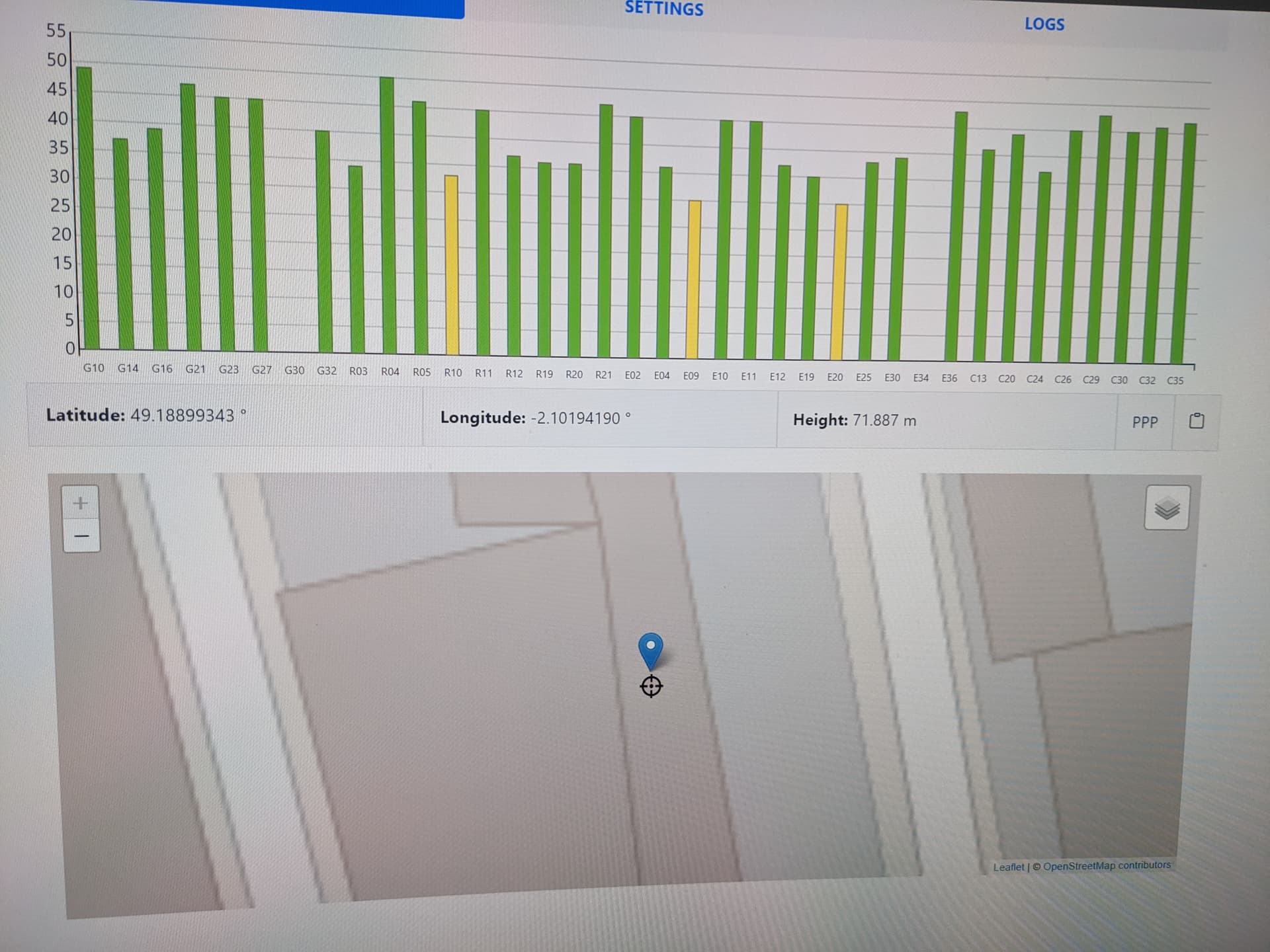
On your first screenshot, the base is registered to an height of -70.89m and on the 2th screenshot the realtime position is +71.88m
It looks like your - before height is incorrect.
btw: your signal levels are a not very high for a base station.
this is the base that its working good but is in my house that why i was trying to put one up at the farm
i dont think that the - on will be the cause that the 2tth base isnt worrking as my first base is the same and works fine
Could you paste here the report from Ign?
from the first base or the secod ?
The seconde one
IGN CALCUL GNSS EN LIGNE 13-FEB-23 13:13
BERNESE 5.2
COMPTE-RENDU
IDENTIFIANT DU CALCUL : 2023-02-13T13:12:33Z_185.48.63.5
ORBITES : sgv22491_10.sp3.Z sgv22490_22.sp3.Z
ROTATION TERRESTRE : sgv22491_10.erp.Z sgv22490_22.erp.Z
Systeme de reference du calcul d’apres les ephemerides : IGS14
I/ ELEMENTS EN ENTREE
ENTREE NUMERO : 1 / 1
FICHIER RINEX : 2023-02-12-Base_1jersey.23o
EN-TETE NOM STATION : Base_1jersey
EN-TETE NUMERO : 99999S999
EN-TETE RECEPTEUR :
EN-TETE ANTENNE :
EN-TETE POSITION : 4170086.1387 -150182.5512 4807754.9172
EN-TETE ANT H/E/N : 0.0000 0.0000 0.0000
ELEMENTS RETENUS
RECEPTEUR: :: RECONNU IGS : NON → DEFAUT : SIMULA
*antenne : radome sans indication = ‘NONE’ (DEFAUT)
ANTENNE :> NONE<:: RECONNUE IGS : NON
DEFAUT :>SIMULA NONE<
ANTENNE CENTRES DE PHASE N/E/H :
SIMULA NONE L01 0 0.00 0.00 0.00
SIMULA NONE L02 0 0.00 0.00 0.00
ANTENNE ARP N/E/H : 0.0000 0.0000 0.0000
NOMBRE D’EPOQUES : 2881
DATE DEBUT : 12/02/23 00:00:00.0000000
DATE FIN : 13/02/23 00:00:00.0000000
MISE A JOUR RINEX : /home/GPSDATA/10327/RAW/tmp_0.RNX → base0430.23o
*Eléments du contrôle qualité a priori :
*Observations reçues/attendues : 0% (0/24347)
*Multitrajets 1 et 2 (mètres) : 0.66 UNDEFINED
STATION : BASE
POSITION APPROCHEE (RINEX) : 4170086.1387 -150182.5512 4807754.9172
W 002 03 45.264462 N 49 14 05.122028 143.1114
POSITION APPROCHEE (teqc) : 4170089.1884 -150181.3888 4807760.4382
W 002 03 45.201616 N 49 14 05.165026 149.2556
II/ BASE : STATIONS DE REFERENCE DANS UN RAYON DE 1000 km (MAX : 12)
1 prr2 : 47301m
prr20430.23d.Z => PRR20430.23O
2 bmhg : 50137m
bmhg0430.23d.Z => BMHG0430.23O
3 vlgn : 51546m
vlgn0430.23d.Z => VLGN0430.23O
4 smtg : 66073m
smtg0430.23d.Z => SMTG0430.23O
5 dipl : 71718m
dipl0430.23d.Z => DIPL0430.23O
6 stlo : 74617m
stlo0430.23d.Z => STLO0430.23O
7 vlpl : 75701m
vlpl0430.23d.Z => VLPL0430.23O
8 dolb : 79496m
dolb0430.23d.Z => DOLB0430.23O
9 avra : 80038m
avra0430.23d.Z => AVRA0430.23O
10 lbtm : 90146m
lbtm0430.23d.Z => LBTM0430.23O
11 plmg : 93333m
plmg0430.23d.Z => PLMG0430.23O
12 plst : 94877m
plst0430.23d.Z => PLST0430.23O
DONNEES DISPONIBLES : 12 (/ 12)
III/ TRAITEMENT
LOGICIEL : Bernese GNSS Software Version 5.2
PHASE 1 : RESOLUTION DES AMBIGUITES
LIGNE DE BASE Dist(km) AMBIGUITES RESOLUES
BASE AVRA 80.0 192 42 ( 21.9%)
BASE BMHG 50.1 190 26 ( 13.7%)
BASE DIPL 71.7 132 24 ( 18.2%)
BASE DOLB 79.5 104 20 ( 19.2%)
BASE LBTM 90.1 144 24 ( 16.7%)
BASE PLMG 93.3 102 22 ( 21.6%)
BASE PRR2 47.3 142 26 ( 18.3%)
BASE PLST 94.9 98 18 ( 18.4%)
BASE SMTG 66.1 226 14 ( 6.2%)
BASE STLO 74.6 146 28 ( 19.2%)
BASE VLGN 51.5 108 22 ( 20.4%)
BASE VLPL 75.7 110 20 ( 18.2%)
AMBIGUITES L1 L2 : 1694 RESOLUES : 286 (16.9%)
PHASE 2 : TRAITEMENT FINAL (AMBIGUITES RESOLUES FIXEES)
FACTEUR DE VARIANCE : 2.29
SIGMA_0 : 0.0015 M
PRECISION INTERNE ESTIMEE (MILLIMETRES) :
BASE 99999S999
SX : 1.5 SY : 0.6 SZ : 1.6
SN : 0.6 SE : 0.6 SH : 2.1
IV/ RESULTATS
=================================== ITRF2014 ===================================
POSITION ITRF2014 EPOQUE 2023.110 (10/02/23) :
BASE 99999S999
X: 4170076.5525 Y: -150181.3053 Z: 4807744.8016
POSITION ITRF2014 COORDONNEES GEOGRAPHIQUES :
BASE 99999S999
LONGITUDE -2.062561103 ° LATITUDE 49.234762275 ° HELL 129.1653
W 002 03 45.219970 N 49 14 05.144190 129.1653
=================================== ITRF2014 ===================================
POSITION ITRF2014 EPOQUE 2009.000 (01/01/09) :
BASE 99999S999
X: 4170076.7193 Y: -150181.5529 Z: 4807744.6492
POSITION ITRF2014 COORDONNEES GEOGRAPHIQUES :
BASE 99999S999
LONGITUDE -2.062564418 ° LATITUDE 49.234760185 ° HELL 129.1645
W 002 03 45.231905 N 49 14 05.136665 129.1645
=================================== ETRS89 ===================================
POSITION ETRF2000 EPOQUE 2023.110 (10/02/23) :
BASE 99999S999
X: 4170076.9933 Y: -150181.8628 Z: 4807744.3796
POSITION ETRF2000 COORDONNEES GEOGRAPHIQUES :
BASE 99999S999
LONGITUDE -2.062568536 ° LATITUDE 49.234756661 ° HELL 129.1464
W 002 03 45.246728 N 49 14 05.123980 129.1464
UTM 30 N : E = 568242.836 m N = 5453975.944 m Alt ( EGM2008 via EGM2008_2 ) = 79.975 m
=================================== RGF93 ===================================
POSITION RGF93 EPOQUE 2023.110 (10/02/23) :
BASE 99999S999
X: 4170076.9978 Y: -150181.8617 Z: 4807744.3856
POSITION RGF93 COORDONNEES GEOGRAPHIQUES :
BASE 99999S999
LONGITUDE -2.062568518 ° LATITUDE 49.234756666 ° HELL 129.1538
W 002 03 45.246664 N 49 14 05.123998 129.1538
LAMBERT-93 : E = 331489.387 m N = 6915714.225 m Alt ( IGN69 via RAF20 ) = 80.817 m
CC48 : E = 1331517.498 m N = 7349409.244 m
CC49 : E = 1331608.520 m N = 8238393.604 m
CC50 : E = 1331587.066 m N = 9127366.510 m
================================================================================
QUALITE DE LA MISE EN REFERENCE ETRS89 : RESIDUS N E HE (MILLIMETRES)
| NOM | N E HE | |
| | | |
| AVRA 19621M001 | 1.47 -0.57 9.40 | |
| DOLB 18690M001 | 0.02 -0.34 -2.72 | |
| PLMG 18662M001 | 0.91 -1.52 2.02 | |
| PLST 18661M001 | -1.72 2.02 0.65 | |
| SMTG 19936M001 | 2.86 -1.96 -0.76 | |
| VLGN 18692M001 | -0.52 0.29 -3.98 | |
| VLPL 19924M001 | -0.98 3.55 -3.00 | |
| PRR2 18693M002 | -1.71 -0.90 16.22 | |
| LBTM 18320M001 | -1.62 0.71 1.47 | |
| BMHG 19833M001 | -0.01 -0.74 -2.15 | |
| DIPL 19850M001 | 2.41 -0.31 -9.29 | |
| STLO 19852M001 | -1.13 -0.27 -7.87 | |
| | | |
| EMQ | 1.59 1.52 7.03 | |
EXACTITUDE ESTIMEE (2*SIGMA) :
BASE E_N : 6.8 mm E_E : 6.7 mm E_H : 18.6 mm
################################################################################
RESOLUTION DES AMBIGUITES :
BASE BMHG : 13.7%
BASE SMTG : 6.2%
2023-02-12-Base_1jersey.23o : PEU DE RECEPTION (0 %)
################################################################################
IGN CALCUL GNSS EN LIGNE 13-FEB-23 13:17
FIN DU COMPTE-RENDU
Ok, your height should be positive, not negative.
And you should use the ETRS89 or RGF93 coordinates.
RGF93:
LONGITUDE -2.062568518 ° LATITUDE 49.234756666 ° HELL 129.1538
I don’t understand why you have added a - before the height value.
Please remove it and try again.
By the way, knowing where your base is, you can use the centipede caster.
ok will try it tomorow hopefully that will do it
ok how much better is it ?
just been reading on the website it say not to use the ann-mb antena that the one i have
It’s not better, it’s different.
There is more control on the base station quality, to maintain a good network quality. But there is no ip ban if you have a problem with your base.
And the most important argument, the server is in France, you will get less latency than rtk2go.
Yes, the ann-mb is not a good antenna for a base station. Many base owner switched from a ann-mb to a good antenna and noticed a better Rtk fix stability.
ok but could i try with the ann-mb and upgrate later on ?
I have my antenna on a 10m cable and it works fine. I’m using a Beitian BT-300s survey antenna on the roof of my shop and the cable comes down the side of the building and in through a wall where my base station is located. The fewer connectors in the cable the better. I’m using a TNC to SMA cable.
My radio goes out another 10m cable to the roof where the broadcast antenna is located. I haven’t installed the new antenna yet but it’s a 10 dbi antenna, over 1m in length. It’s a few meters above the GPS antenna and should not interfere.
What is the tablet model and stand you are using?