Depends how you do it, I guess. Maybe it’s more like using AgIO to handle the GPS/NTRIP stuff in the background?
1 Like
For Opengrade3D in grading mode I think it’s better to have a completely separate software, anyway it use a different receiver on the blade vs the one on the tractor.
When AOG will support an implement receiver it would be a option in my opinion.
For surveying it would be nice to have an add-on.
1 Like
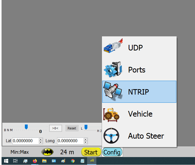
Where in the program I can config the NTRIP, I cant find it ![]()
Ntrip is only built in Opengrade3D
For Opengrade you must use some external correction.
OpenGrade3D:
Thanks Patrick, I see.
Will you give me a quick setup how I have to start in a field.
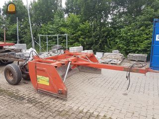
We have like this one.
I have to learn the program, the. I can build GPS om it
Do you want to level using an Optisurface design file(Opengrade3D) or in standalone mode(Opengrade)?
For standalone you can watch @BrianTee_Admin 's videos, search “opengrade” on Youtube for some nice videos!
Hi Patrick, I dont know? What is the best?
Is it difficult and expensive to make 3d designs?
With Opengrade3d I have the NTRIP client.
Jack
The Optisurface software cost about 1000 USD and is good for 140Ha if I remember correctly.
There is a learning curve, there are a lot of parameters you can adjust.
In my area there are lot of agronomists offering map design service for about 10$/Ha + 100-200$ per field.
The minimum is 4Ha, but you can combine nearby fields.
OpenGrade3D is good for leveling whole field as you need the 3d design.
The biggest advantage is that you don’t have to worry much about the target height because the whole field is already calculated
OpenGrade is more for working in little zones as you survey a path, then put a target height along the path and you are then able to grade some distance each side from the path.
It’s more for local correction vs whole field.
It’s really about what is your goal. I use both.
1 Like
Thank Patrick for the explanation.
See our field https://www.google.nl/maps/@52.7919479,4.7370735,1335m/data=!3m1!1e3
They are almost flat, we need a slope about 4-6 cm from one side to the other side. Almost all fields are 3 to 5 hectare in our area.
Can you make more paths (side by side) with Opengrade from the hole field and make a slope line for the hole field in two directions? Or is the 3d map then necerssary?
If i will start the procedure to survice a field. How to do? First drive around the boundary and then side by side by pressing record?
I get this answer from Optisuface:
Below are the steps:
- Reply to this email (support@optisurface.com) and attach your topographic data file (eg .txt or shapefiles etc).
Also include any background information, instructions or guidelines such as:
- What crops are you planting?
- Are you irrigating? If yes, how?
- Are you planting along beds/furrows or does your planter leave small beds/furrows? If yes, in what general direction. i.e. north to south and how high?
- What are the problems with the field you want solved e.g. ponding, infiltration uniformity, erosion
-
We will send you analysis and an initial design, within 1 to 3 working days, based on our experience and your instructions.
-
You can review the analysis and design and suggest any changes you wish.
-
We will send you a revised design back and repeat this feedback/revise loop until you are completely happy.
—- Everything to this point is FREE. —
I forgot that you can have design made directly by Optisurface!
In my opinion it will give a better result with Optisurface (less soil moved, less time needed) if you have easy access to a designer.
Yes, you would survey side to side then draw your reference path. then you can move up or down the whole line if you are moving to much/ not enough soil.
If you go for the design file:
OpenGrade3D will give a .ags file, you will need a .adg file from them.
To survey:
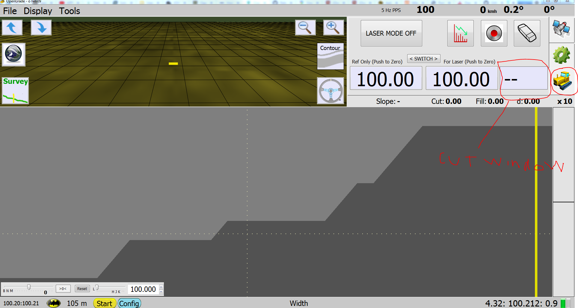
Press on “Grade Mode” or “Survey Mode” on the bottom bar to go in survey mode
Once a field is open click on Survey to begin.
First you have to put the benchmark(reference point): drive to a known location and press the button.
Now you are in boundary record, press start to start.
When boundary if done press again to begin the survey points. you can drive in any direction, it will put a point every time there is no point 3 meter apart.
You can practice in simulator mode.
Are you in negative altitude? under sea level? Survey should work, but grading could give some errors, it was in my plan to change this in the code.
Right now it’s possible that some actions only happen when altitude is above 0. -1 is used for no altitude, have to change to -1000.
I guess Im late to the party…
I have been talking with ezigrade about integrating leveling into the program…
Here is where Im at. I am familiar with ezigrade, not proficient… but while talking to them I was able to get them to export target,actual,/n in a string format…
I wrote some code to convert that to deere format (0-5V) GitHub - Chris8960/EZIControl: To make EZIGrade work with a deere Touchset Controller
Crude yes, but it works and controls the machine… I did not get a chance to test under “load” both software and hardware yet, but that is on the agenda…
Where I am curious is using GC3d in the machine to control the hydraulics… BTW all hydraulics for deere, case, and cat can be controlled in a similar manner… basically 0 to 5 volts with 2.5 being neutral… there is some dead band but generally, less than 2.5 one way, over another…
this method should be available in most machines built post 2003.
My plan is to do some testing and get a general feel for GC3d in the next couple of days
Link is broken for me.
I don’t think it is public.
It should work now… I had to make the repository public.
2 Likes
What is everyone using for grade control? Just want to do simple grading with manual control of the hydraulics? Seems to be 3 or more options on GitHub and don’t know which one to use. The opengrade3d v1.1.1 has an Ntrip built in, would that work?
I guess I am a bit confused. Is there an opengrade and then an opengrade3d? If so what are main differences and where do I find either or both? I found opengrade3d under Pat-l but not sure where most current version of opengrade is, or if there is one.
Thanks
Your best option for standerd Open Grade is Pats V2.1.3
Feel free to keep asking questions. Maybe it would be helpful if i knew what kind of project you are working on. So i could advise standerd or 3D
1 Like
Just a simple blade used to drain a few small areas. Want to be able to survey area, make the cut and then check to make sure have decent slope for drainage. Not controlled by a valve, just manual hydraulic control, just want the open grade to survey and confirm slope. It’s actually for a neighbor, I am just supplying the gps for project so learning as we go.
Thanks
He mentioned that gps on screen had funny looking characters in input lines. I assume that’s because I have gps set too fast or too many strings going to it.
He also mentioned that it wasn’t showing the grade lines on screen. He was using 2.12 I believe
I would install Open Grade 2.1.3 from pats github (See link above) You will need RTK for sure. The general process is to start a new field. survey line or curve with the blade brushing the ground were you want the water to flow. draw a cut line using the on screen touchpad. ( find in taskbar lower right). Then your inches above and below grade will show up in far right window when you are in the dozer tab.
Thanks, will try that today. I didn’t know about drawing the cut line so will do that.
Search “OpenGrade” on Youtube and watch @BrianTee_Admin videos, it works still the same, there are just more settings/options in my version.
1 Like