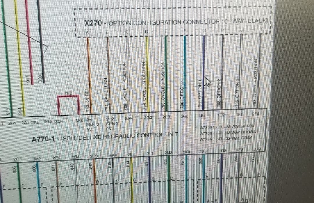
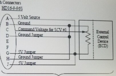
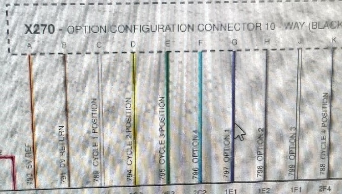
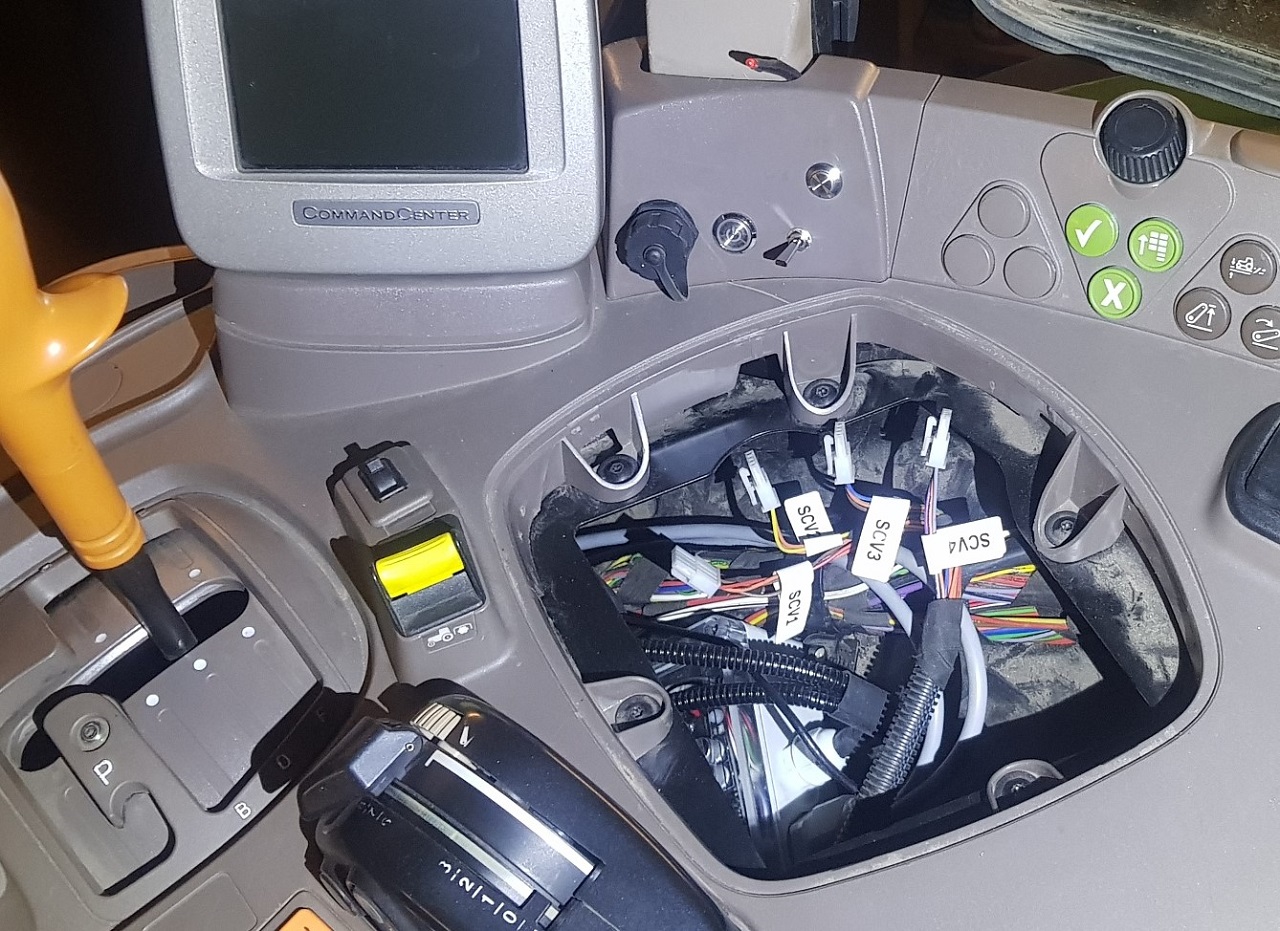
I see, so there’s only one connector, just send signal into C for #1 or D for #3 accordingly. Any idea what the Option Pins do?
This sounds like a very promising way to use the built-in valves with the option to override from in the cab. I definitely want to try this for my drawbar planter steering this spring and for tiling in fall.
It would be useful to raise and lower an impliment/do functions that are controlled with the arduino. It would just be limited to the scv’s listed, machine moving, and the lever in forward detent.
so ive got a little bit of a problem i think. Been trying to make a agd file to run in open grade 3D. recorded my points in ft with ezi grade. Than designed job in ft with ezi grade. It opens up in OG 3D but it seems to think that it was an metric file. Is their some way that it could read the ft file. it would not be an easy job to re survey. Its an old sand pit with water in it. Had to walk out on ice and poke an gps pole down thru holes to get an idea of bottom.
Yes OG3D only read numbers and assume it’s metric.
You can send me the file in PM.
the agd but also the survey files if possible
I can make a quick modification in OG3D so you can use it.
A dirty fix only take a few minutes
After I will have to look how to make it without make it to complicated.
Like asking the user for metric or feet? Or maybe auto-detect, like searching of “m” or “ft” on the first line.
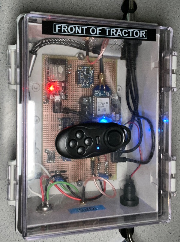
Got a chance to add the IMU to V3 should have roll comp now. I was searching for options to have something physically in your hand to control OG, as I know touching a screen as you are bouncing across the field sometimes isn’t all that easy. And I think I found a nice little way to control open grade from a cheap handheld Bluetooth remote, can program 9 different functions to each of the buttons . (Auto engage, blade offset up, toggling screens ect.) Seems to work pretty well.
2 fixes. 1. Read into excel or libreoffice and do the calculation of the existing and proposed elevations.
1 meter = 3.2808399 ft.
Or an easier option is to open ezigrade create a new file, set to meters and recreate the map you made… this will dump the file out in meters. This is the option I have been using… I just do the math in my head for the cut fill and yards/ac to cubic meters/hect (divide metric by 2 to get a rough approximation of imperial)
I have been meaning to get ahold of Steve at ezigrade to be able to select meters or feet upon export of the file.
Is there any suggestions from those who have used openGrade, for things they would like to see controlled by the remote? I have added all the functions I think will be useful, but I’m curious if there are more that you all have come across?
I use mostly in dozers. Doesnt seem like something i would use that much. Now a nice PCB built around the ardusimple RTK2B. That would be exciting. And an bluetooth gps connection to tablet! But for auto work in a tractor can see where the remote would be nice.
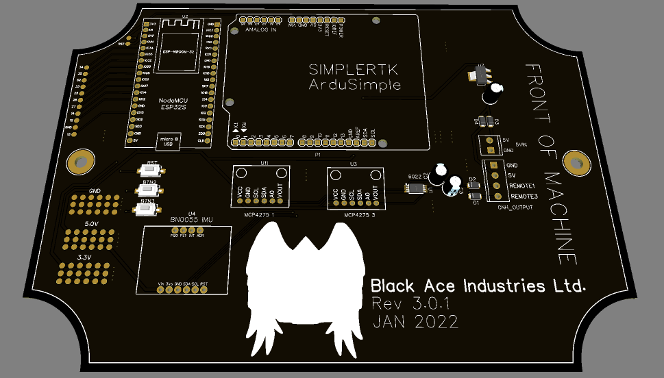
I have the PCB all designed, just making sure I have all the components on it to make sure it is safe against voltage spikes and things of that nature as I don’t want to accidentally fry someone’s ardusimple chip, or worse yet something in the tractor. As for wireless I have worked on it a bit, I will use wifi instead of Bluetooth just to get a bit better range. Few more kinks to work out with it but should be ready In the near future.
I will post a picture of it when I get back to my desktop, it uses DAC’s like @ChrisC first implemented. I have deviated quite a bit from the original OG so unfortunately I don’t think it will be backward compatible with the other versions out there. As it uses different communication methods than the original, or @Pat ’s versions.
Anyone with an electrical background that would like to take a look at the Gerber file and make some recommendations. Shoot me a private message and I will send the file to you.
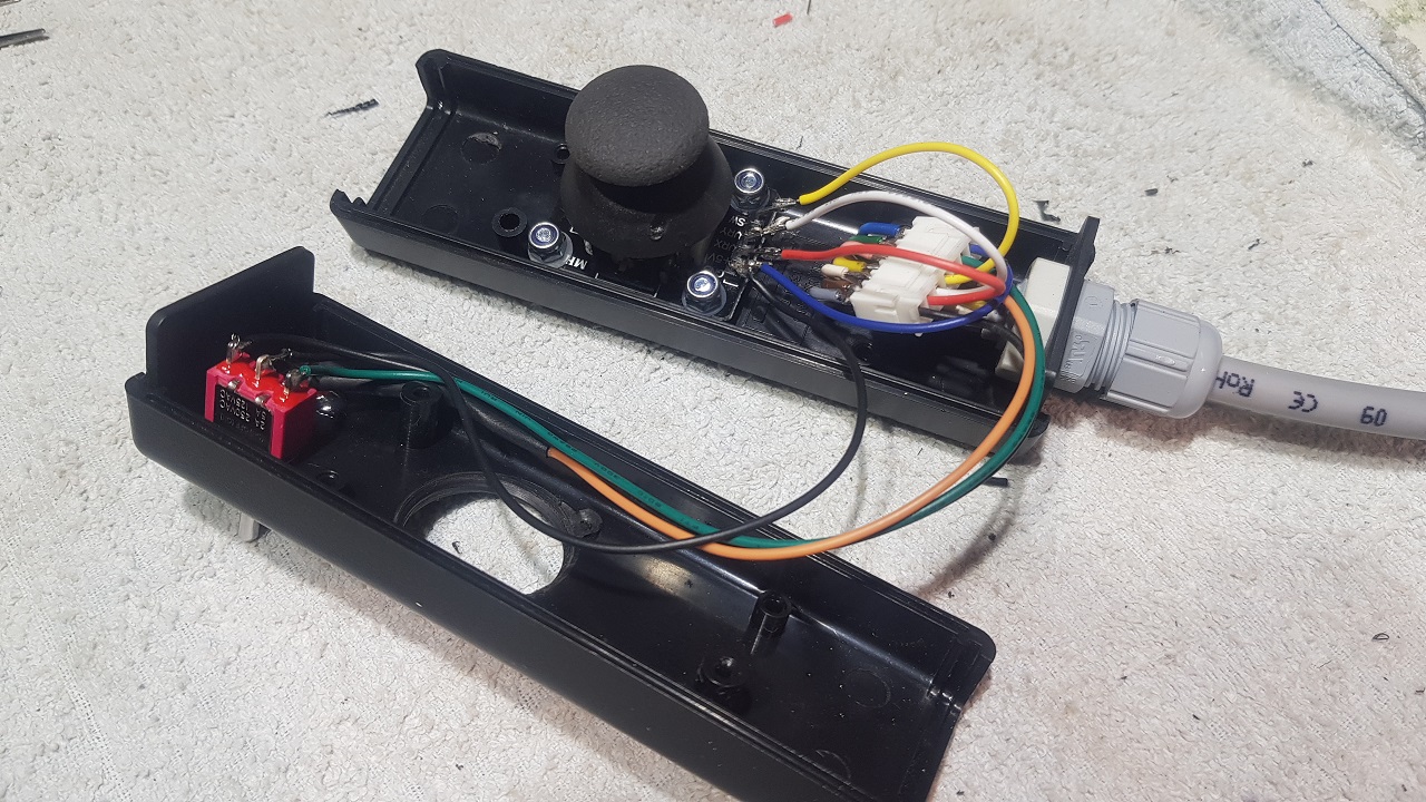
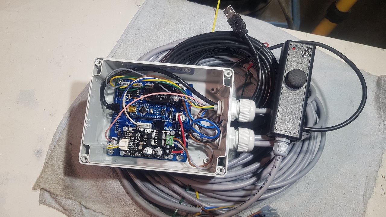
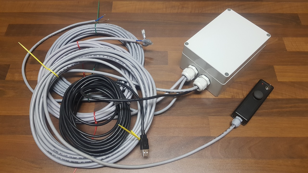
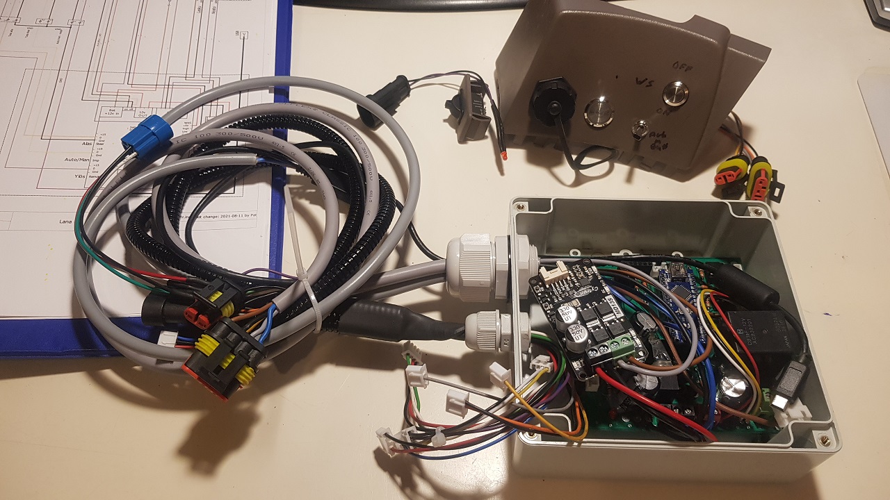
I’ve done two OpenGrade boxes on KaupoiMOD pcb. One for myself permanently mounted on a John Deere 6630 and one for another farmer to mount to a field grader. I used Pat’s ValveControlPropLever.ino in them. Although I haven’t tried it with grader yet, everything seems to work. And I got one hydraulic block more for my John Deere.
Looks good and certainly there is potential to put for sale such systems in a wider scale.
It might make sense to include also a GNSS receiver + wifi NTRIP master or radio module in the same box. Radio module, if the user would bring a portable base on the levelling/ditching/tiling site, allowing for sligthly smaller deviations.
Also an antenna could be packaged there so that the lid of the box would serve as a ~20 cm ground plane for the antenna. All at the top of a sturdy pole on a leveller or ditching machine.
We have used a neighbours 5 m wide Turkish land leveller for a few times and next May I’m hoping to rent it again for grading a 30 ha field that has been ruined in the past decades with bad ploughing. Need to come up with a setup that is easy to mount & dismount so could be used also with other cultivation tools as well to map and move small amounts of soil always when operating with anything that has a hydraulic levelling bar.
Finland has available lidar height data of pretty much whole country at 2x2 m grid resolution. I have a feeling that this data could be used to generate rather good levelling plans for all fields without specifically surveying first. One could the survey while doing the rough first levelling pass that starts with the public data. They are now producing also 1x1m and 0.5x0.5 m grid lidar scans, so that will be definitely enough. There is both, raw lidar data and also processed height maps.
For billing/calculating the amount of earth to be moved, the higher the resolution, the higher the cubes of soil
Yes there is so many options. I prefer separate GNSS module so that it can be used easily with other applications too and user is not stuck with one manufacturer.