I am just getting started with BlackAce/OpenGradeX. I am more C# programmer not so much Farming or Grading Equipment guy so go easy on me. Any newbie tips, good doc sites or helpful hints? I have the source from GitHub already cloned. Two goals: one is to get it talking to an Emlid Reach RS2, is that considered an “antenna” in OpenGrade terminology? Broadcasts on UDP port 8888. Second, I want to build my own “fields” from existing plan files. Any documentation on those directory and file formats? Let me know if there is a better way/place to post this.
1 Like
Yeah the RS2 is a antenna, or receiver whatever you wish to call it.
Open grade x is just a wireless extension of the original open grade. If you are looking to do 3d contours Opengrade3D may be the better project to look into.
Can you describe how you create a “cut line” using the OSX? I just want to survey a contour and apply a cut line to it. I can see how to do it in fields.txt but not through the user interface. I don’t have a joy stick or vehicle connected up yet. Are those required to make a cut line?
If it’s easier to record a quick video, that would be even better. Thanks!
Once you have sureveyed a line go up to the grader tab and click on the button with the finger on it you can then apply the cut line, you can also do a autocut from that will populate the cut line according to a min slope setting. I think the version of OGX is a few commits behind so there still may be some bugs.
Top right of this image
Does the RS2 work with OGX or is it strictly your Black Ace board it links to?
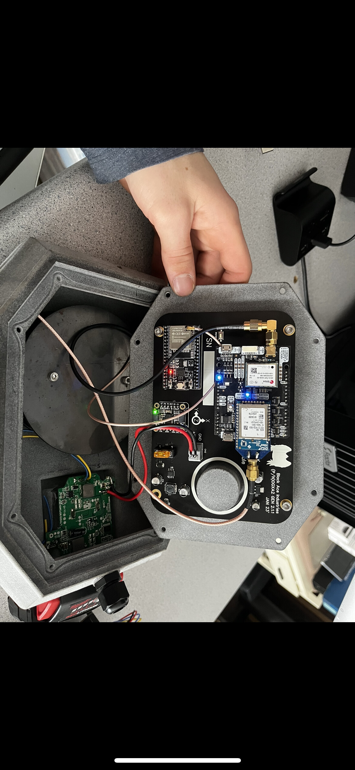
Just curious, did the boards function like they were supposed to? If you would ever consider releasing the Gerber files I would be interested
The boards seem to work fine but I think I will have to do some change ups to the power supply side of things before I release the gerber files as the current voltage regulators I use get a little warmer than I would like on the antenna boards. We just got underway with harvest though so that will all be down the road sometime now.
2 Likes
Did you get the open OGX working with the Emlid reach rs 2?
I did, but I wrote my own TCP/IP connection to the device and read NMEA strings from there.
Well. It works
6 Likes
Where do you find the config button? Does it have the udp set up under it?
Hi BlackAce,
Have you had any more chances to test your system?
I would be interested in building one myself, would you be willing to release the PCB at this point?
Thanks
Hi Everyone,
First of all, great project.
Hopefully this is a simple question and if anyone has any ideas that would be great. Once I get around 23 meters away from the survey line the function like target depth stop reading and it stops showing the hight indicator. I would like to work up to 100 meters away from the survey line if possible. If anyone has any ideas they would be greatly appreciated.
Thanks
should be able to change the distance from survey line in config
Actually i couldn’t find that setting in OG X maybe just an option in OG. @BlackAce would be your guy on this.
I have managed to get the current hight line to draw when I am further away from the survey line by changing the (minDist <) to 9000 rather than 500,. This was in the OpenGL.Deisgner file shown below.
I am having problems finding were to make changes to keep the readout of cut information and bar graph once I get further than 21 meters form the line. I am assuming this is the same reason I lose blade control once these functions drop out as there is nothing to control the blade hight.
 if (minDist < 9000)
                {
                    //draw the actual elevation lines and blade
                    gl.LineWidth(8);
                    gl.Begin(OpenGL.GL_LINES);
                    gl.Color(0.95f, 0.90f, 0.0f);
                    gl.Vertex(closestPoint, (((pn.altitude - centerY) * altitudeWindowGain) + centerY), 0);
                    gl.Vertex(closestPoint, 10000, 0);
                    gl.End();

                    //the skinny actual elevation lines
                    gl.LineWidth(1);
                    gl.Begin(OpenGL.GL_LINES);
                    gl.Color(0.57f, 0.80f, 0.00f);
                    gl.Vertex(-5000, (((pn.altitude - centerY) * altitudeWindowGain) + centerY), 0);
                    gl.Vertex(5000, (((pn.altitude - centerY) * altitudeWindowGain) + centerY), 0);
                    gl.Vertex(closestPoint, -10000, 0);
                    gl.Vertex(closestPoint, 10000, 0);
                    gl.End();

                    //little point at cutting edge of blade
                    gl.Color(0.0f, 0.0f, 0.0f);
                    gl.PointSize(8);
                    gl.Begin(OpenGL.GL_POINTS);
                    gl.Vertex(closestPoint, (((pn.altitude - centerY) * altitudeWindowGain) + centerY), 0);
                    gl.End();

                    //calculate blade to guideline delta
                    //double temp = (double)closestPoint / (double)count2;
1 Like
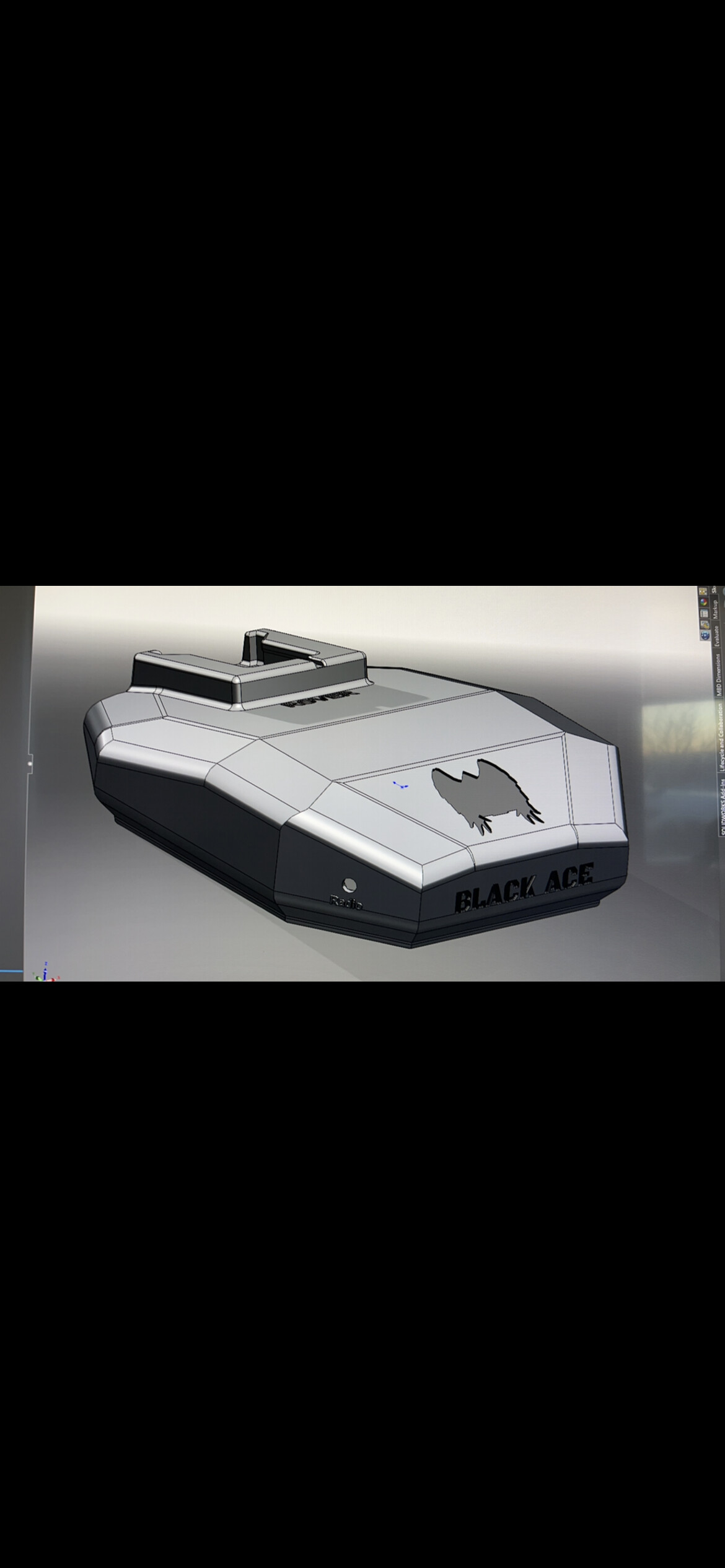
New commit today on GitHub with all the lessons learned from the last year. Many of the things discussed here have been fixed. As well as many other things added after that I found would be helpful using it over the last many months.
Have my sites set on 3D now. From picking through the grade control thread and reading through @Pat version of 3D I don’t think it should be too much to add, as I will be able to copy a large portion of the code.
I have been doing some reading and I think Optisurface seems to be the right choice and its offered at a digestible price. I plan to get it to read both the agd files as well as LandXml files as they seem to standard and allows for possible Open source options like QGIS in the future.
Any suggestions from those who worked on 3D in the past?
3 Likes
How are the PCB’s coming along?
2 Likes
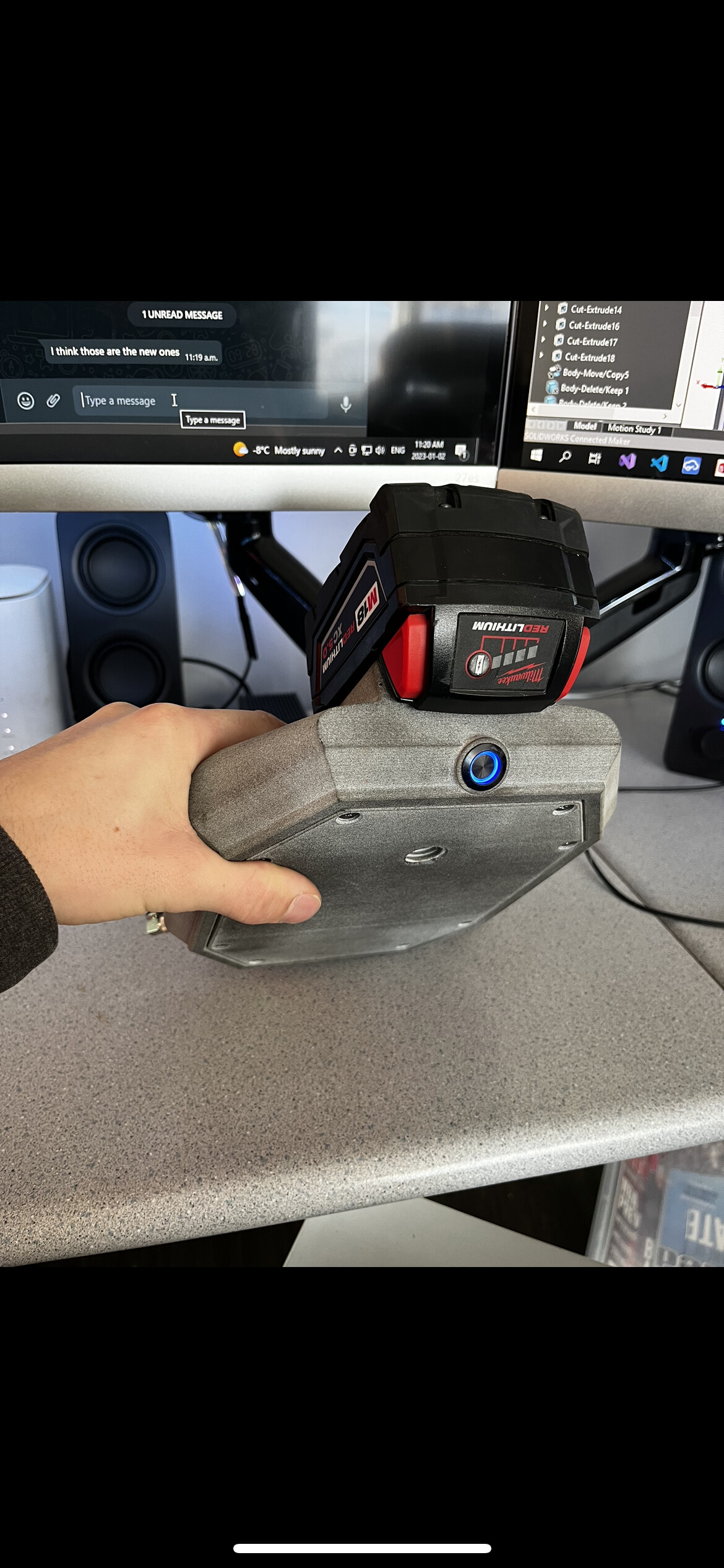
That looks awesome! I love the idea of a battery for ease of installation. Have you or anyone else successfully used this with a John Deere tractor? Also, do you plan to release the PCB files for this new design?
1 Like
Yes very excited this looks awesome! The battery doesn’t block satellite view?
2 Likes