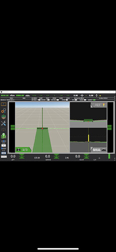
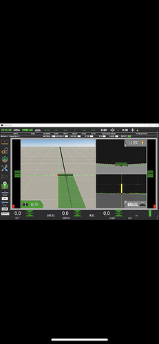
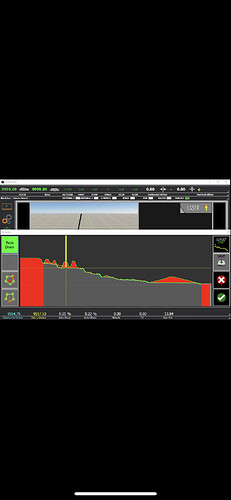
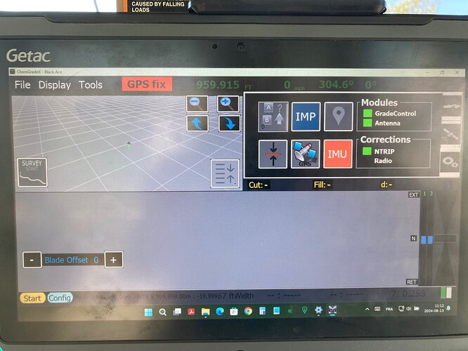
3D will be neat
Looks like someone has been busy. Nice work!
Looks proffessional. Is this latest version on GitHub? How have your wireless GPS modules panned out. Are they still working well?
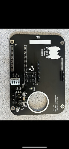
The latest version isn’t on GitHub no. Still to many bugs in it. Still lots to figure out as well. Wireless has worked pretty seemless for me and the few systems I have out there so far. I have 30 of the antenna boards made up. I plan to sell them for $200 CAD+ shipping to try and recoup some of the cost in developing OGX. They are some assembly required but work with the sketches on GitHub. Don’t have many of the Grade control boards but if there is enough interest I can order some more.
To anyone who is interested if you plan is to buy this I want to stress that I am a farmer with a full time schedule so if you’re looking for support on how to set it all up this isn’t going to happen. I think most people on here understand that but I want to be clear on it. I hope the few that are still interested can help in building up a knowledge base on here similarly to what has happened with the AOG project.
I’m curious how long the antenna board runs on a 5.0 AH battery?
A very long time. I had a board run for over 12hrs and according to the little LEDs on the battery it didn’t use half the battery.
This looks amazing! I love the enclosure, is it 3d printed? Are the files available for that in your GitHub? My brother has been contributing a bit to the main AOG project, and I’ve been giving him to look at your project. We are interested in buying a set of boards to try out, do you have them available still? Is it two boards? One for the wireless unit on the implement and another in the tractor? Sorry I guess I should dig around the GitHub a bit more and learn more about the boards etc.
I love the wireless concept, thanks for all your hard work!
Just looking into buying optiSurface, curious if you’ve made any progress on the 3d stuff?
Keep up the good work!
Just an idea, i would like output pins on the antenna esp, for height / level led´s, with the wi-fi connection it would be perfect for a “drain tile box” (video, not mine just for explanation). Opengradex can be used as it is now, but it would bee much better to have eyes on the bucket wile dragging, i dont know anything about programming, so dont know if its possible, and how much work it would be.
Thanks for all the work that is put in to this.
https://www.youtube.com/watch?v=foyFq0yzZOM
Just curious what the DRO’s is for. Maybe just solving the acronym would answer my question…
Hello, I’m new here, I would like to set up a system with * Opengradex * but I’m currently stuck, I got myself an esp32 nodeMcu with the adafruit bno055 (2472) and the ardusimple f9p card. When I launch the esp32 with IDE monitor, the antenna module IP address appears and after it immediately displays No IMU, I revalidated and revalidated my assembly but I don’t see why it doesn’t work, I saw after some research that the bno055 had a certain communication problem with esp32 in IC2, I got to this stage. If I understood the INO file correctly, when starting the esp32, the first step is to acquire the imu data then the UDP step and the wifi step, if it does not acquire the imu data at the start , it stops there I think? or it still continues the other steps and sucessfully connect to host server? I would like to know if any of you have successfully completed this assembly, maybe i skipped a step too or I have a component that is not the right one for this assembly… I would need help.
I used the documentation available and the schematics on github opengradeX from BlackAce
Sorry for my writing, English is not my native language
Thanks in advance
It’s impressive to see all the work you have done!
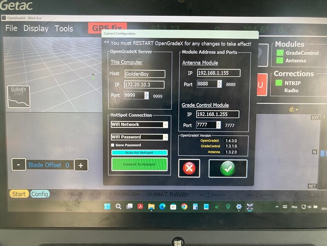
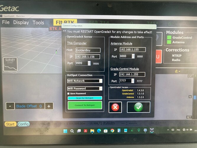
Hello, I finally solved my problem, just updated my IDE and my library. Now I can establish the connection of the antenna module as well as the control module, but I am currently encountering another problem, I want to use the ntrip option to obtain the fixed rtk and I use my iphone as connection sharing by plugging in the -this has the tablet with the usb cable but as soon as I connect the iPhone the IP address of the tablet is replaced… the connection with the 2 modules remains with ogx but I get fixed rtk only 10sec after it I fall back to GPS fix, has anyone already had this problem using ntrip, I already use ntrip with AgOpenGPS with my base and it works very well but I am out of ideas for OGX. I tried to use the IP address of the iPhone 172.20.10.3 to adjust the coding but the DNS of the iPhone 172.20.10.1 and I don’t know much about the ip config side.
THANKS
A little curious here. Does OGX compensate for the curvature of the earth or if you set it to 0% slope, for example, would that line just head off in to space? Obviously need some distance for that but anyway ![]()
It uses the GPS altitude so I would say it use the earth curvature.
But I guess in most cases the difference would be smaller than the GPS or machine vertical precision anyway.
Probably so except for some of our drainage ditches. For example we have some field ditches that are 1/2 mile long. If the earth curves 20.3 cm in a mile, which is what water would level out to, since that is determined by gravity. Then on a 1/2 mile ditch the center would be 10 cm higher then if it was a straight line. That amounts to quite a lot of dirt that wouldn’t have to be moved if gps calculates slope based purely on elevation. However with a laser making a straight line we are in essence creating a dish for water to sit in, although that dish does happen to be at an angle. Many years ago there was a man in the community here that had the money and resources to fill in all the ditches on a 40ac or so field and leveled the whole thing level with a laser. His theory being if the whole field was level then the water could only get so high before it ran off. Needless to say, but he had a 40ac pond when the first rain came along. The idea probably would have worked better if he had used GPS and done it all at one elevation, hence a slight dome. Probably would still have been sketchy drainage at best though, anyway. ![]() Does that all make sense or am I thinking about it wrong?
Does that all make sense or am I thinking about it wrong?
@Pat So you know if the cut line that we draw on the screen after surveying is laser straight or GPS/alt straight?
GPS alt straight.
Since if you would survey a very long line it would still appear level in the side cut.
It put the target altitude to each design pt which are about 25 cm apart.
Then while driving it will pick the closest pt and try to reach this altitude.
OG or AOG don’t make any modifications to altitude like they do to lat/long to adjust it to a planar grid in meter.
It seems that having an accurate attitude measurement is not easy. Depends of your reference point.
Wondering if there are Gerber files available somewhere for the two boards?
Is there a list of the components needed for this project? I’ve downloaded the software and like what I see! Just want to see what it will cost… Wondering if there are PCB boards for sale? or are there files to upload for the boards? also like the 3D printed enclosure. I’d be interested in files for that or to purchase ready made. Thanks
See the very first post for a link to the GitHub repo
I don’t think he’s shared any of the PCB designs which is unfortunate as he’s also not made them available for purchase either.
