I just today learned from the National Land Survey of Finland that they have been distributing openly live data of their 20 calibrated top quality base stations to an Europe-wide network of CORS stations. Below are links for all interested parties. Somewhere there is also a link to a corresponding worldwide list of services.
After testing 3 different FREE Govt owned Finnish RTK base signals, located at 68 km, 90 km and 108 km distances from my home, my reported location remained within 5 mm of each others. I used F9P based Fieldbee reveiver and Lefebure NTRIP Client. Unfortunately the Govt had never bothered to inform the citizens about the availability of this data, but that changed today.
I believe many of you may find a nice RTK base to connect to, following the info on this page and registering with one of the three service providers with an username & password.
Below is a link to the map of all such (mostly Govt owned) base stations, with their mountpoint names when you click the balloons.
For older Topcon, Trimble etc you may have to edit the messages in RTKLIB or SNIP to cut out/modify the messages so that the receivers are happy, but my F9P-based receiver seems to be with the correction signals as they are broadcast.
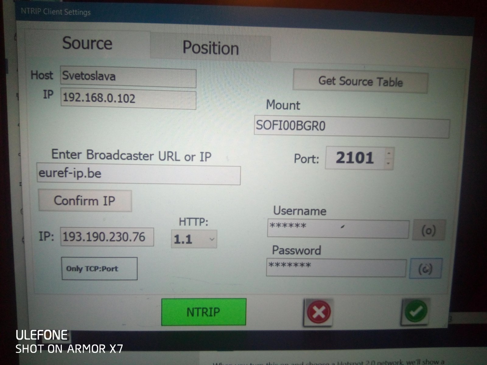
I’ve had an account for almost 10 years but via Belgium. I understand the accounts are via Belgium, Germany or Italy (be careful with the caster IP-address, depends on your registration).
If I remember right, either none of just a couple of Finnish stations were available when I registered. Looking at the map now, even 20 is not ideal at all when they do not provide any virtual base service (not for free). I wonder if RTKLIB or some other application could build a virtual base with a decent amount of processing power?
I agree that such a sparse network of single bases is not ideal, but I checked that at least with F9P the accuracy seemed ok with my closest base at 68 km distance.
Virtual network RTK would be great, but indeed every user adds processing power requirement, if aiming to match the user location. Even creating virtual base stations to the centre of each 3 base station triangle could help to offset some of the distance issue. That way no need to calculate separately for each user.
As of 1.1.2022 Finland also has now available to purchase the raw correction data from all 90 national RTK bases, so that commercial operators can pay & develop value added services, like nearest base, network RTK etc.
That’s new, I asked about this more than a year ago and then they didn’t share the RTK corrections, only DGPS has been public for a long time. Thanks for the info!
This data has been there freely from these 20 stations since 2018, but no-one bothered to tell to potential users. The ministry and land survey personnel were mostly all unaware themselves.
We would now need to find the best way to limit satellite number to max 12, with 1004 and 1012 RTCM messages, since that would provide true legacy combatibility for older Topcon etc.
Isn’t the max 12 satellites an issue with some very old Trimble screens? My Topcon (AGI-4) would love more than 12, almost always the case with GPS + Glonass. AGI-4 does need RTCM 1004 and 1012 and more but the conversion is straightforward with RTKLIB.
EDIT: inspired by the later comment from Alan.Webb, I have to correct that the AGCO branded AGI-4 variants would need RTCM 1004, 1012 and some other RTCM messages, would not work directly from EUREF MSN messages (if I remember right when I tried last time, they only provided MSM for the base stations of interest to me).
At least DGPS corrections must be limited to 12 satellites with AGCO AG3000, which is like handicapped AGI-4. With RTK over 12 might be okay. Also could be the difference between outdated AG3000 and most up to date version of AGI-4.
Interesting, never used DGPS, only RTK with AGI-4. We discussed the option to limit the number of satellites with an F9P base mainly for the purpose of reducing data transfer and ignoring satellites that are too low and not used be the rover anyway. I don’t think there was any setting. A pity as both the max number of satellites and minimum elevation are simple to configure on my old Novatel base. But we are already know how clever Canadians are.
Did you indeed register at the service provider ROB (Royal Observatory of Belgium)? euref-ip.net would be for BKG (Germany) and there is also ASI (Italy). Easy to mix up at least ROB and BKG addresses.
If you registered on several of the three service providers, then it may be misleading which one has activated the account and which has not. One service provider should be enough.
I found that euref-ip.net apparently only uses ipv6 address and built in AOG NTRIP can’t resolve such DNS name and find source table. The same with Fieldbee’s mobile NTRIP-client.
Not a problem with Lefebure NTRIP Client on Android phone though. Maybe you should try with Lefebure (without gps, or with just internal gps) so can double check.
Also, not all service providers stream all base station streams.