Data management

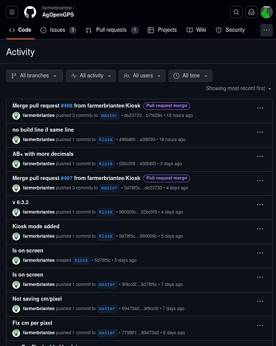
I’m trying to keep historical data without continuing to stack field names and am wondering how to do it without degrading accuracy?

Example 1: Separate tasks on the same field (spray, then plant) Would like to keep the application data.

Example 2: Share A/B lines with other fields. Sometimes its all one block of land but different crops where spacing can be maintained but it’s just called a different field. I tried edited the ABLines.txt but that wasn’t the answer. Is 100% of the accuracy retained when ‘extracting’ the AB Lines from the Field.kml file?

Example 3: Sync vehicle settings among multiple vehicle tablets / computers. From what I’ve seen the .xml’s in the Documents directory only update once closing or any time you open the vehicle settings menu. It also seems like they do not hold all the data if you simply sync that particular folder.

I tried Syncthing this spring but it ended up being a mess any time more than one application was open, conflicts galore. I could run them in offline mode but then they both make changes and end up with conflicts anyway. I basically would like to know the structure of data management so I can make my own syncing/file management proper and not loose accuracy or data.
1 Like

Not sure it is 100% what you are looking for but here is a thread.

Also, maybe FarmOS could provide some of what you need.

I’ve come across that same thread in my searches before I posted, looks great but pretty in depth at the moment.

The main goals right away:

  1. Accurately share AB Lines / Boundaries (can be manually, just need to know what to edit to properly update all relevant files). I am also concerned about losing accuracy but came across a post saying Earth doesn’t truncate the actual coordinates, just doesn’t display them?)

  2. Share or sync all vehicles. I believe there is a couple different files involved so I’m not sure it’s as simple as keeping the default Vehicles folder synced…

Its not stored in a database. Maybe you want to much. It’s old technology.


What’s old technology? :slight_smile:
The most basic is to zip up the folder in ~/Documents called AgOpenGPS. This contains all the fields, vehicles, and AgIO settings. Then send to your other tablet over some messaging platform… I use telegram, because I already have it on all my tablets.

Probably ideally would be a git-like setup, where you would ignore the section/contour data, until explicitly told to send it.

#1 Yes, I think split it by coverage map “layers” or jobs.

#2 I believe the AB lines are saved in the field’s local coordinate system, all relative to the “home” or “start” position (0,0) where you were when you first created the field. I too would like to copy ABs sometimes but so far you’d have to create all the fields with the same start position or it might work to open the kml in Google Earth and export it back to AOG. If you create one field without a boundary, then create new fields from that first one for each additional field, they should all have the same start position.

#3 Can you pinpoint what data isn’t saved in the vehicle XMLs? I sync the AOG documents folder using my self hosted Seafile server and it seems to work but mostly as a backup so far.

Here’s a chat message from BSE I saved for my own future reference:

For all those who have asked for multiple device support here, I have done some tests and depending on what you want to achieve, it works well with Syncthing.

I cross-synced the complete documents folder, for test, with 3sec.

AB lines, flags and marked areas only appear on the other tablet once the field has been closed and reopened.

If you assign different colors to the two rovers, both markers are displayed correctly later.
Even if both rovers are working on the same field at the same time.

If both rovers open the same field at the same time and create new ABs, they will all be present after reopening.

The same applies to flags.

Of course, this does not work for tramlines. There is only one file for this.

But this way, all vehicle fields and the lines can be shared across several rovers almost in real time.

It works frighteningly well.
Can post some pictures/videos if desired.

For one farm i let sync them all together. 2 or 5 Rovers dosnt matter.

Yes, all tablets point to the Documents/AgOpenGPS folder.

Sync Conflicts only shows up, when two or more Tablets have the same Vehicle open. And then u get a file with conflict in the name.

But normaly, only on vehicle is used per one tablet;).

All other stuff syncs fine!

And as i wrote, when u set all Tablets other colors, they all shows up.
But not lifetime when field is open. U have to close and reopen it.
Also for AB, Flags and Co.

#1 Right now I manually open the ‘Field.kml’ in Google Earth then Save-As to a new file name in my backup directory

#2 I understand the Coordinate System is confusing/complicated (which is why the 0,0 method is used), but this makes sharing AB Lines manually impossible, correct? I’m guessing the only way to share them without re-creating fields would be to extract them in Google Earth then import the AB file into the desired field while running AOG? If this is the correct process, is ANY loss in AB line accuracy?

#3 Can anyone verify if this is the process yet (link explains vehicle.xml process)?

Interesting comments on someone’s experience with Syncthing, I too noticed vehicles getting conflicts, but also the AllFields.kml file. I haven’t had both tablets in the same field at the same time so that probably eliminates conflicts on most if not all of the Field folder data.

I mean, you can’t use the same setting files with several applications.
Modern apps are not as robust as AOG.

1 Like